From the 1950s to the 1970s, San Francisco—along with many other American cities and strategic areas—was protected by batteries of Nike missiles against a possible attack by Soviet bombers. One of those missile sites, SF-88, has been restored by the National Park Service and is now open for tours.
This video presents a history of the Nike missiles as a whole, followed by a tour of the SF-88 site. I shot the video on a visit to the site in May of this year. I did a fair bit of reading before writing the narration. Secondary sources about the Nike missiles are surprisingly sparse. One commonly-cited book, Rings of Supersonic Steel (see bibliography below) was written for enthusiasts, and I didn’t find it very useful. Another book, The Last Missile Site, was much more useful for me, because it provided both the broader context of the missiles and detailed information about the site. I based the second half of the narration heavily on information from this book.
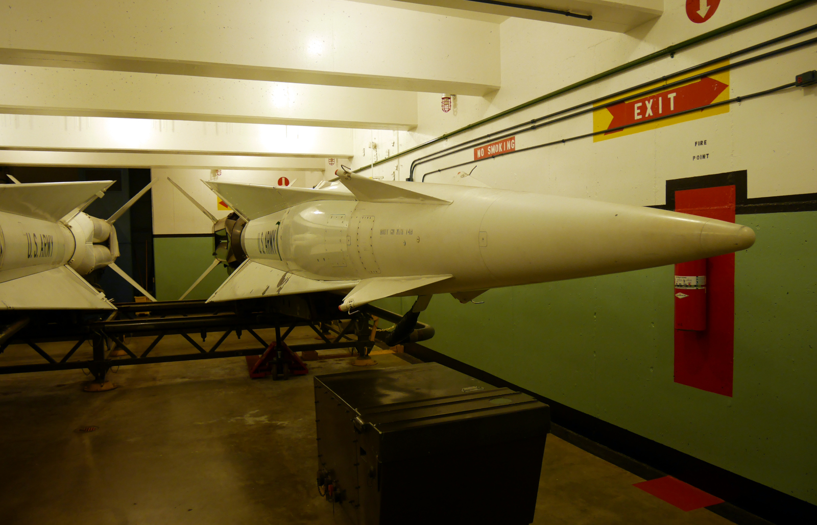
A Nike-Hercules missile in its underground magazine at SF-88, awaiting launch.
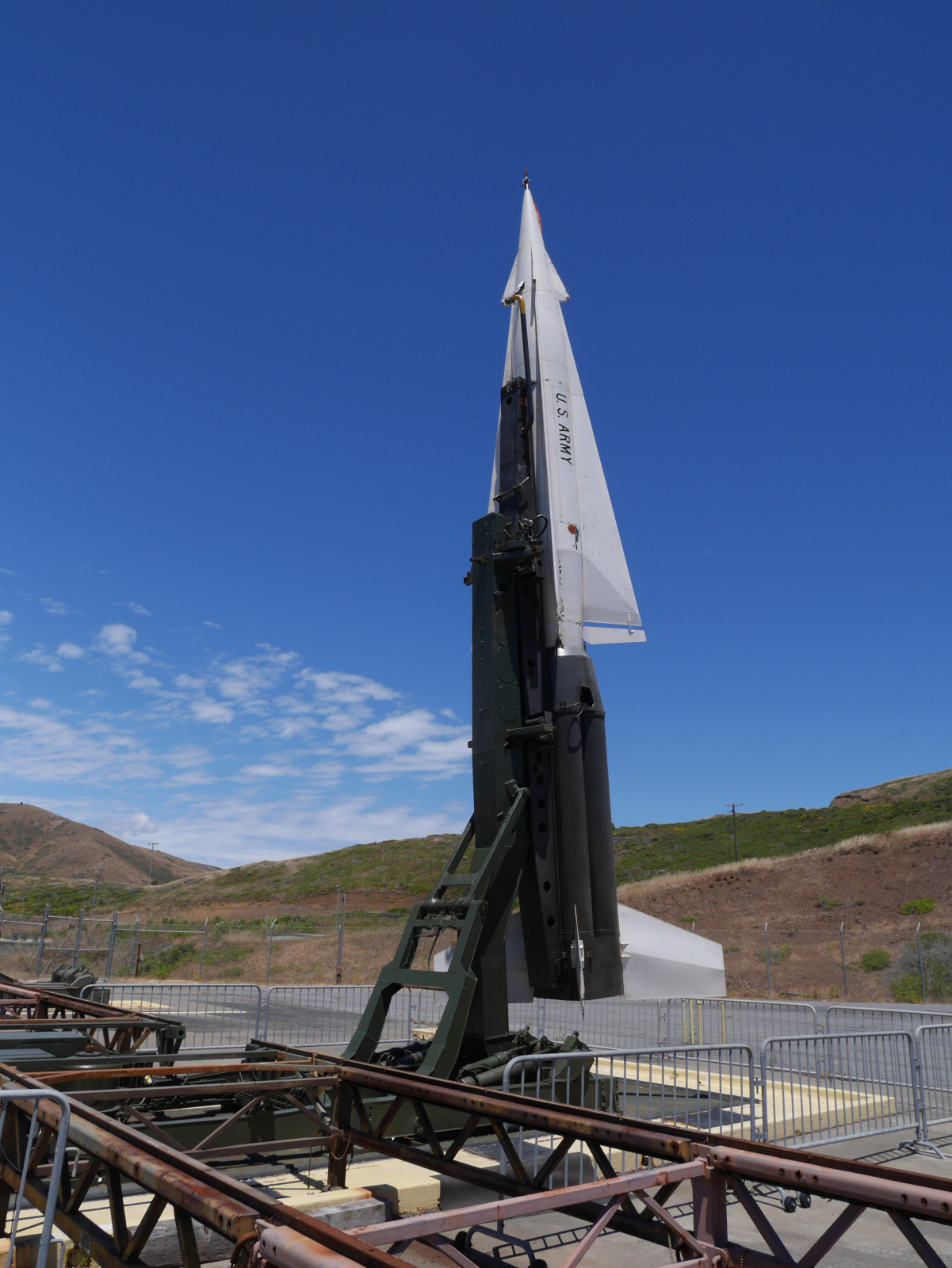
A missile erected in launch position.
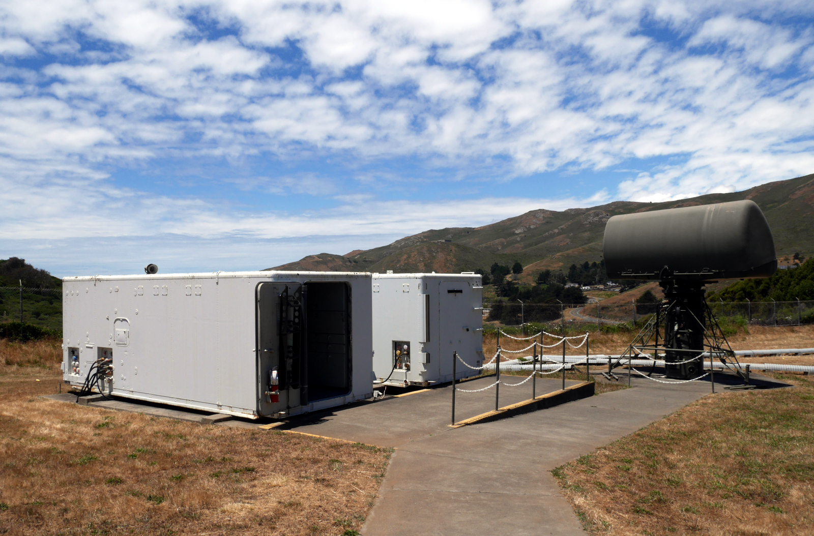
Trailers from Integrated Fire Control, originally on top of Wolf Ridge (background), but now down at the launch area for easy access. The trailer in front is the Director Station Trailer; the one in the back is the Tracking Station Trailer.
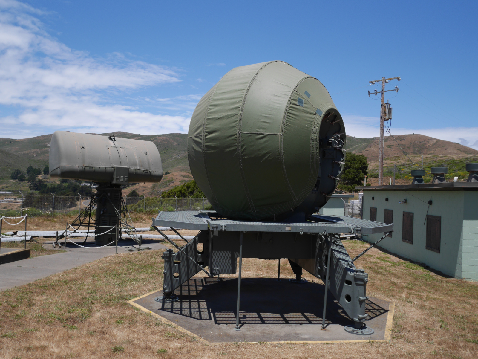
Two radar antennas, also originally on top of Wolf Ridge. The ball-shaped antenna in the foreground is a Missile Tracking Radar (the Target Tracking Radar and Target Ranging Radar looked identical to this); the rectangular antenna in the background is the Low-Power Acquisition Radar.
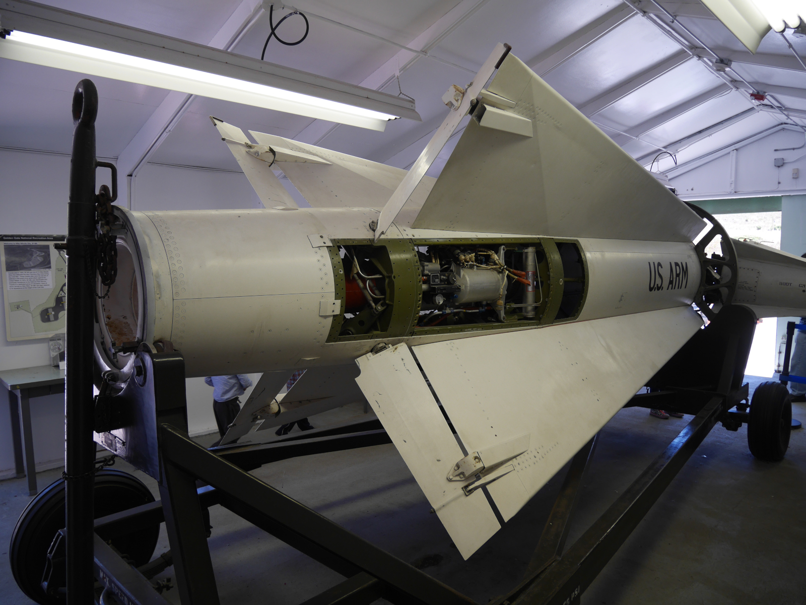
A Hercules upper stage in the Missile Assembly and Test Building.
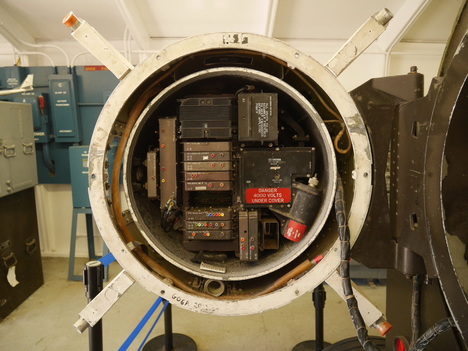
Some of the electronic guts of the Hercules upper stage.
Bibliography
“A fatal first for the Nikes.” Life, June 2, 1958, 40.
Davidson, Bill. “Can Nike X save us?” Saturday Evening Post, August 27, 1966, 19-21.
Golden Gate National Recreation Area. “Cold War Era, 1952-1974.” National Park Service. https://www.nps.gov/goga/learn/historyculture/cold-war.htm.
Haller, Stephen A., and John A. Martini. The Last Missile Site: An Operational and Physical History of Nike Site SF-88, Fort Barry, California. Bodega Bay, California: Hole in the Head Press, 2010.
Morgan, Mark L., and Mark A. Berhow. Rings of Supersonic Steel: Air Defenses of the United States Army 1950-1979 – An Introductory History and Site Guide. 1992; 3rd ed. Bodega Bay, CA: Hole in the Head Press, 2010.
Smith, John. “On Nike Duty: Anti-Aircraft Missiles Protected Nation During Cold War.” Army Magazine, May 2020, 42-46.
Thompson, Craig. “They Didn’t Want That Guided Missile.” Saturday Evening Post, September 9, 1955, 36-37, 90-92.
Ubell, Earl, and Stuart H. Loory. “The Death of Nike-Zeus.” Saturday Evening Post, June 1, 1963, 15-19.