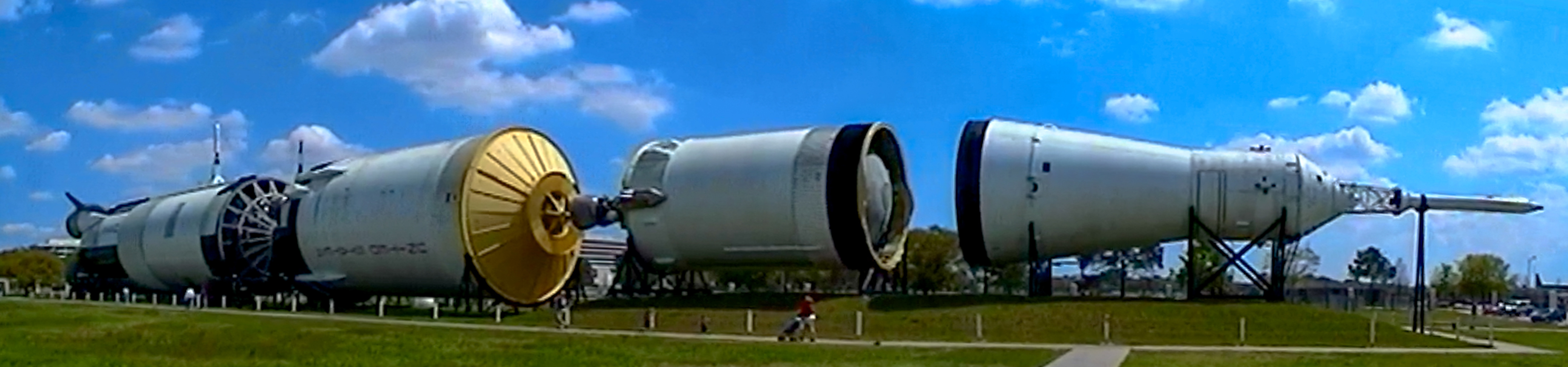
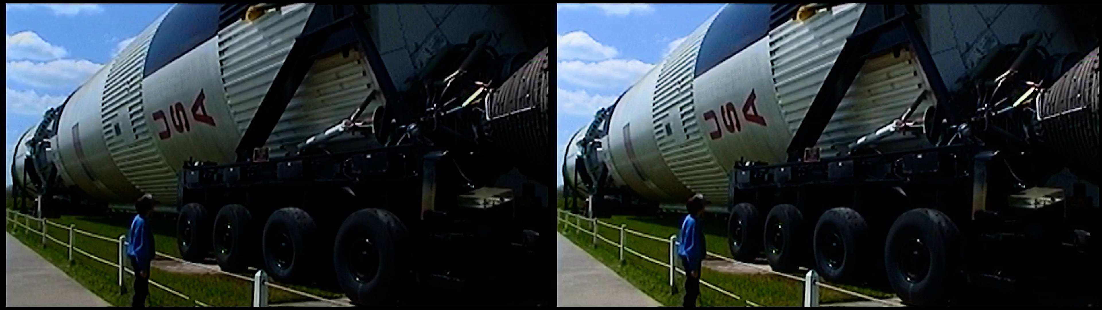
WillyLogan.com

Technology, History, and Place

Category: Videos (Page 1 of 4)

Panoramic view of the Saturn V.

Johnson Space Center from Gemini to the shuttle era

Johnson Space Center in Houston, Texas is synonymous with NASA’s human spaceflight program for much of the general public—especially those of us who grew up watching Apollo 13. In 2003, back when I was a high schooler, I visited Johnson Space Center for a nerdy spring break. Twenty years later, I revisited my memories and video footage from that trip to make the video embedded above about the history of JSC and what I saw when I visited.

Photos from my 2003 visit to Johnson Space Center: Your blogger and his parents posing between the S-IC and S-II stages of the Saturn V rocket on display.

Photos from my 2003 visit to Johnson Space Center: Your blogger and his parents posing between the S-IC and S-II stages of the Saturn V rocket on display.

My father taking a photo of the Saturn V.

My father taking a photo of the Saturn V.

Panoramic view of the Saturn V.

Panoramic view of the Saturn V.

In writing the script for this video, I relied heavily on Suddenly, Tomorrow Came…: A History of the Johnson Space Center, by Henry C. Dethloff [PDF]. It is a NASA History book, and as usual for books in that series, it is academic and well-researched, but also well-written. Other NASA History books I referred to included The Space Shuttle Decision, by T.A. Heppenheimer [PDF]; and Stages to Saturn, by Roger Bilstein [PDF, print].

For a video of this length, in which only a portion of it consists of footage that I shot, it was a real challenge to find archival footage or stills to match the narration. The NASA Image and Video Library was useful, and I always looked there first. Its holdings are limited, though, especially for material older than 10 or 15 years. The best source for archival footage of the Apollo program in particular was the National Archives and Records Administration, which has quite a lot of digitized footage, much of which is in HD. NARA was less useful for the Space Shuttle. I also found Internet Archive to be indispensable, because it has plenty of high-res stills and mostly low-res videos about the Space Shuttle, which I couldn’t find anywhere else even though they were created by NASA.

Back in 2003, consumer-grade HD video cameras were not widely available. Camcorders recorded video on tapes in SD (480p), either in analog format or digitally. I used a Sony DCR-TRV340 camcorder, which recorded digital video in D8 format on tapes that were backward-compatible with the analog Hi8 tapes that our previous camcorder had used. The camera had an IEEE 1394 Firewire port, which allowed a computer to capture video from the tapes in lossless digital format. Since I no longer have a computer with a Firewire card, I used a ClearClick Video2Digital Converter to transfer footage to my computer for this video. The quality of the transfer probably wasn’t perfect, but it was definitely good enough.

Overall, my video footage from 2003 was of disappointing quality. The cuts and camera movements were fast, and the colors were ugly. I couldn’t do much about the camerawork, but I could adjust the exposure and colors in Premiere, vastly improving the appearance of the picture. I’ll make it a point to do these adjustments whenever I use my old video footage in the future.

mom-in-svmf-comparison

mom-with-sic-comparison

Side-by-side comparisons of camcorder shots before and after manipulation.

Side-by-side comparisons of camcorder shots before and after manipulation.

Sources for the video

Bilstein, Roger E. Stages to Saturn: A Technological History of the Apollo/Saturn Launch Vehicles. 1980; repr. Washington, DC: NASA History Office, 1996.

Dethloff, Henry C. Suddenly, Tomorrow Came…: A History of the Johnson Space Center. N.p. [Houston, TX]: Johnson Space Center, 1993.

Heppenheimer, T.A. The Space Shuttle Decision: NASA’s Search for a Reusable Space Vehicle. Washington, DC: NASA History Office, 1999.

Olasky, Charles. “Shuttle Mission Simulator.” NASA conference publication, 11th Space Simulation Conference, 1980. NTRS, 19810005636.

The ugly rivers of Southern California

Recently, I was down in Southern California to do some research in the Water Resources Collection & Archives at UC–Riverside. On the way back north, I stopped in Montebello, east of Los Angeles, to visit the site of one of the last battles of the Mexican-American War in California, the Battle of Río San Gabriel. On the afternoon of January 8, 1847, Californio forces under the command of José María Flores tried to prevent American troops from crossing the San Gabriel River as they headed toward Los Angeles. Having read about the battle beforehand, I was able to picture the site in my head: a wide, shallow river, with a sandy bottom, bordered by willows on either side.

Painting of the Battle of Río San Gabriel by James Walker. The description of the picture identifies it as the Battle of Los Angeles, which was a different battle the next day (also known as the Battle of the Mesa). But I’m almos certain that this actually portrays the Battle of Río San Gabriel, because it matches the accounts of the battle, and doesn’t match the Battle of Los Angeles, which was a running engagement. (Source: Wikimedia Commons.)

Painting of the Battle of Río San Gabriel by James Walker. The description of the picture identifies it as the Battle of Los Angeles, which was a different battle the next day (also known as the Battle of the Mesa). But I’m almos certain that this actually portrays the Battle of Río San Gabriel, because it matches the accounts of the battle, and doesn’t match the Battle of Los Angeles, which was a running engagement. (Source: Wikimedia Commons.)

What I saw instead was very different: a massive concrete channel, littered with trash but without so much as a trickle of water flowing in it or a blade of grass growing along its length as far as the eye could see.

What the Battle of Río San Gabriel site looks like now. (Note that this is actually the Río Hondo rather than the San Gabriel River; see below.)

What the Battle of Río San Gabriel site looks like now. (Note that this is actually the Río Hondo rather than the San Gabriel River; see below.)

I was surprised by what I saw, but I shouldn’t have been. Come to think of it, all of the rivers I had seen in the greater Los Angeles area were heavily engineered. The river in Montebello was a twin of the more-famous Los Angeles River (and in fact is a tributary of it). The Los Angeles River borders the downtown area and has hosted chase scenes in various movies (including Terminator 2). Looking down at the engineered river channel in Montebello, I couldn’t help but wonder:

Why are the rivers of Southern California so ugly?

When I got home, I found the answer in a book in my library. The book was The Los Angeles River: Its Life, Death, and Possible Rebirth, by Blake Gumprecht. According to the book, the flow of the Los Angeles River varied widely between the seasons. During the dry summer months, the river would be a lazy, languid stream, meandering this way and that as it flowed down from the mountains to the sea near Long Beach. But in rainy winters, the river could become a raging torrent, washing away houses, farms, animals, and people.

Los Angeles proper was not vulnerable to flooding so much as the towns up- and down-stream of the city. As the Southland developed, and buildings and pavement took over land that used to absorb rainfall, the problem of flooding got to be more acute. Attempts to deal with the problem at the local level had limited success. Then the Depression came, and the federal government took over responsibility of flood control on the Los Angeles River. After a devastating flood in 1934, the Army Corps of Engineers began to channelize the Los Angeles River and line it with concrete. (An even more catastrophic flood in 1938 highlighted the need for better flood control measures on the river.) Between 1936 and 1959, the Corps channelized almost the entire length of the Los Angeles River.

Scene from the construction of the concrete channel of the Los Angeles River, 1938. (Source: UCLA Library Digital Collections, CC BY 4.0)

Scene from the construction of the concrete channel of the Los Angeles River, 1938. (Source: UCLA Library Digital Collections, CC BY 4.0)

What about the site of the Battle of Río San Gabriel? Surprisingly, while the battle took place on the San Gabriel River, the river that flows by the site now is actually the Río Hondo, a completely different river! In 1867, before the flood control measures were built, the San Gabriel shifted its course to the east and the Hondo occupied the old channel of the San Gabriel. Flood control works on the Río Hondo and the modern San Gabriel River were built in the mid-20th century, at the same time as the Los Angeles River. The Army Corps completed the Whittier Narrows Dam on the San Gabriel River and Río Hondo in 1957.

The concrete river channels of the Los Angeles area were (and still are) marvels of engineering, but they are also ugly and obviously predate the modern environmental and beautification movements. Still, it’s hard to imagine Southern California without them, and we seem to be stuck with them for the time being.

Fort Point, guardian of the Golden Gate


Immediately under the south end of the Golden Gate Bridge stands Fort Point, a US Army fortress that protected the approach to San Francisco Bay during the Civil War. Fort Point is one of the best-preserved coastal defense forts of its era, and one of the few major sites of Civil War significance on the West Coast.

The Army built Fort Point as part of the Third System of Coastal Fortifications, which were built between the end of the War of 1812 and the beginning of the Civil War. Most of the Third System forts were built on the Atlantic and Gulf Coasts. When I lived in Alabama in grad school ten years ago, I visited several Third System forts; some of my pictures of those forts appear in this video.

While I enjoyed visiting those forts, I was disappointed to find that many of them had ugly concrete batteries from a later era, the Endicott System, built right inside them. Not even iconic Fort Sumter, where the Civil War began, was spared this fate! But Fort Point didn’t have any concrete gun batteries built inside it, as there were plenty of more convenient sites for the big guns elsewhere on the Golden Gate (and they probably wouldn’t have fit anyway). Although Fort Point is hardly in pristine condition (all of its original guns are missing, and the fort was modified in an abortive attempt to convert it into a second prison like Alcatraz), the fort is substantially complete, and it is easier to envision how it was used in the 1800s than it is while visiting many other Third System forts.

When researching this video, I found no shortage of secondary source material about Third System forts in general and Fort Point in particular. Some of this material was produced by the National Park Service for its own use in maintaining and interpreting the site. Another very useful source was (surprisingly) a Master’s thesis from the U.S. Army Command and General Staff College at Fort Leavenworth, Kansas, which provided a wide-angle view of Third System forts that other secondary source material lacked.

Fort Point under Golden Gate Bridge

Fort Point is nestled under the southern end of the Golden Gate Bridge. It is easy to miss, but well worth taking the time to pay it a visit if you are in San Francisco.

Fort Point scarp wall

The southern or scarp wall of the fort, which was the only wall that did not face the ocean.

Fort Point gorge wall

The gorge wall in the interior of the fort, on the same side as the scarp wall. This is where the officers and enlisted men had their quarters.

Fort Point powder magazine

The reconstructed powder magazine of Fort Point, in the scarp side of the fort. (This display was under renovation when I shot this video, which is why it does not appear in the video. I took this picture in 2019.)

View of the parade ground inside Fort Point. The three arched tiers around the courtyard are the casemates, where the guns were mounted to protect against enemy ships.

View of the parade ground inside Fort Point. The three arched tiers around the courtyard are the casemates, where the guns were mounted to protect against enemy ships.

Fort Point vaults

The vaults in the casemates.

Fort Point roof

View from the top level of the fort.

Sources

  • Charlesworth, Timothy J. “Defending America’s Shore: A Historical Analysis of the Development of the U.S. Army’s Fortification System, 1812-1950.” Master’s thesis, U.S. Army Command and General Staff College, 2000. https://apps.dtic.mil/sti/pdfs/ADA384106.pdf.
  • Cultural Resources and Museum Management Division. Abbreviated Fort Point Historic Structure Report. San Francisco: Golden Gate National Recreation Area, 2006.
  • National Park Service. Fort Point. N.p.: Government Printing Office, 2017.
  • Smith, Mark A. Engineering Security: The Corps of Engineers and the Third System Defense Policy, 1815-1861. Tuscaloosa: University of Alabama Press, 2009.
  • Stephenson, John. “Deterrence in Stone: Seacoast Fortresses of the 19th Century.” Periodical: Journal of America’s Military Past 20, no. 2 (summer 1993): 10-18.

Page 1 of 4

Powered by WordPress & Theme by Anders Norén