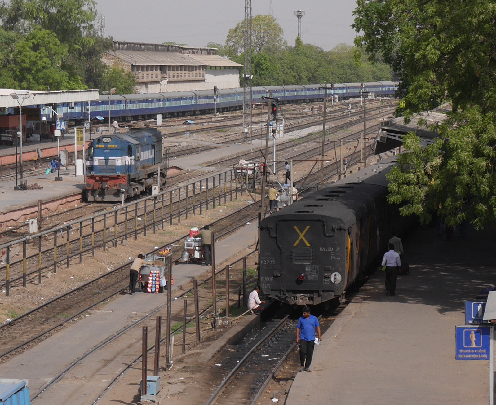
Broad-gauge (left) and meter-gauge (right) trains at Jaipur Junction.
When private British capital first started building railroads in India in the mid-nineteenth century, the lines were built in broad gauge. With a spacing between the rails of 5 ft 6 in, this was, and still is, the widest rail gauge in common use anywhere in the world. The colonial Government of India started to build their own rail lines in the 1870s. These public-sector railways were more cheaply built than their private counterparts, and they were made in meter gauge (3 ft 3 3/8 in).
Even after independence and the nationalization of the private railways, broad-gauge and meter-gauge lines continued to be developed in parallel with each other. Only in the 1990s did the Indian Railways start to convert meter-gauge lines to broad gauge, under Project Unigauge. Since then, large stretches of meter-gauge lines have been replaced by broad gauge.
Meter-gauge lines survive here and there. One such line runs between Jaipur Junction and Sikar, 107 km (66 mi) to the northwest. Meter gauge used to run all of the way to Churu, another fifty miles to the north, but that stretch has recently been closed for conversion to broad gauge. (The time table posted in Jaipur Junction station still says Churu on it, although the name has been whited out and replaced with Sikar.) Someday the Jaipur–Sikar line will also become broad gauge. But in the meantime, seven meter-gauge trains will continue to run back and forth between Jaipur and Sikar every day.
Since meter gauge won’t be around forever, I felt obliged to ride the Jaipur–Sikar train when I had the chance. A month ago, I rode one of these trains from Jaipur as far as Chomun, one-third of the way to Sikar. The meter-gauge tracks at Jaipur Junction station are on the north side of the broad-gauge lines, so the tracks don’t have to cross each other. I found a place where both gauges run side-by-side, showing the difference in size.
Comparison of meter gauge (left) and broad gauge (right).
The meter-gauge train was smaller and, I dare say, cuter than the broad-gauge trains I am used to seeing. Inside, the coach was just wide enough for a bench seating four or five adults.
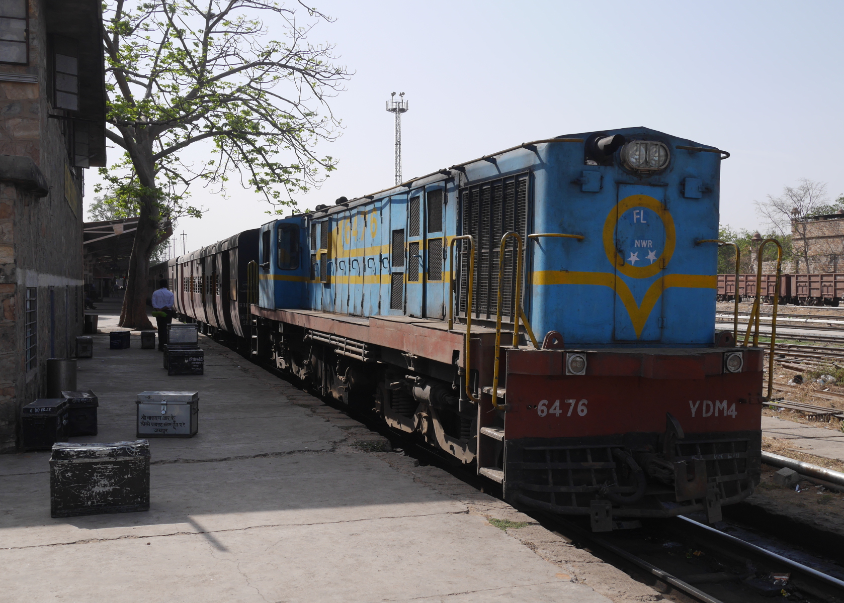
Meter-gauge locomotive of 52083 Jaipur-Sikar MG Pass train.
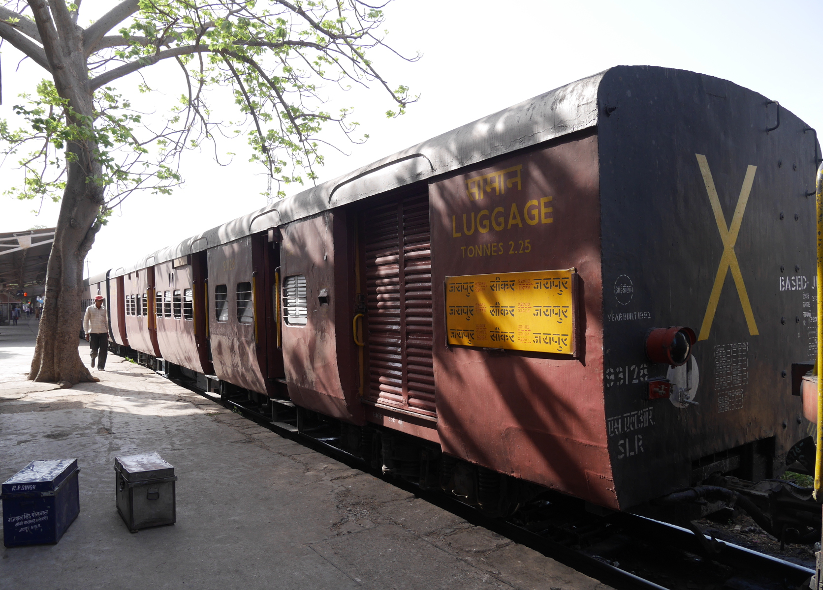
Meter-gauge luggage car.

Panorama of a compartment in a meter-gauge train.
I sat in the coach just behind the diesel-electric locomotive, because that one was farthest along the platform and nobody else was in it at first. When the train left Jaipur station, only two other men were in my compartment. At the first stop, Dher ka Balaji, the compartment filled up. The train passed by Jaipur’s sprawl for a while, then it reached the open countryside. After several station stops that I didn’t see the name of, the train pulled into Chomun station, a nice little colonial Public Works Department structure.
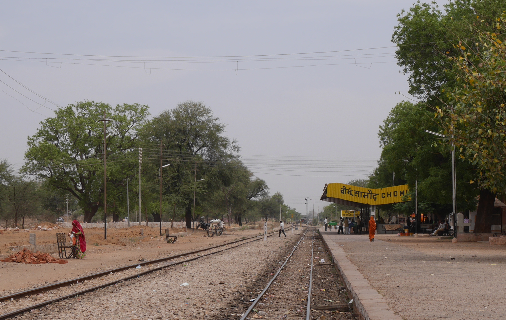
The single platform of Chomun Samod station.
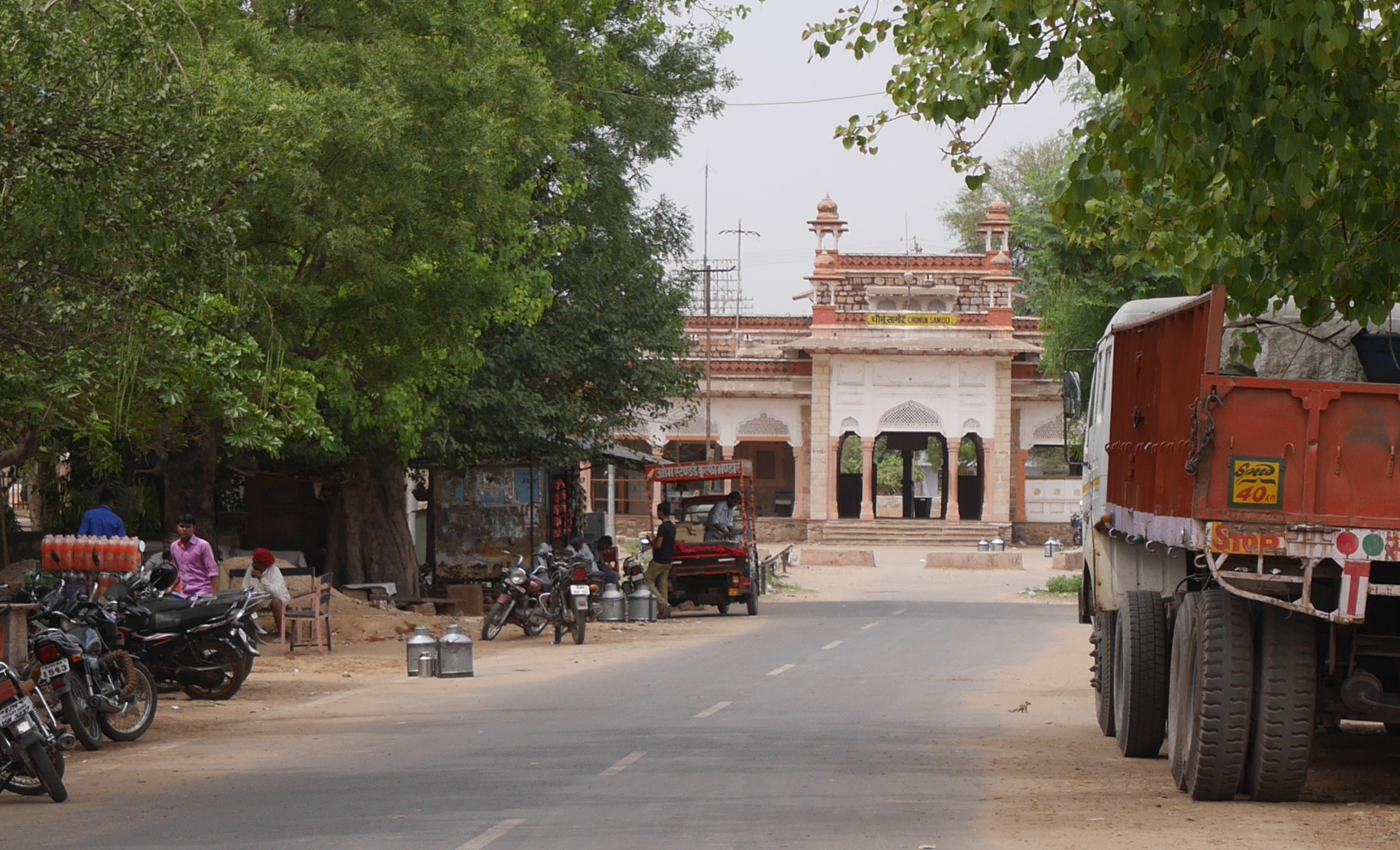
Glimpse of the facade of Chomun Samod station.
At Chomun, my meter-gauge technological tourism came to an end. I returned to Jaipur by city bus.
Having ridden on a meter-gauge train, I can now appreciate how much the Indian Railways have changed since the days when the narrower gauge was more prevalent. The train I rode to Chomun just didn’t have the capacity of the much larger broad-gauge trains I have ridden in India.