
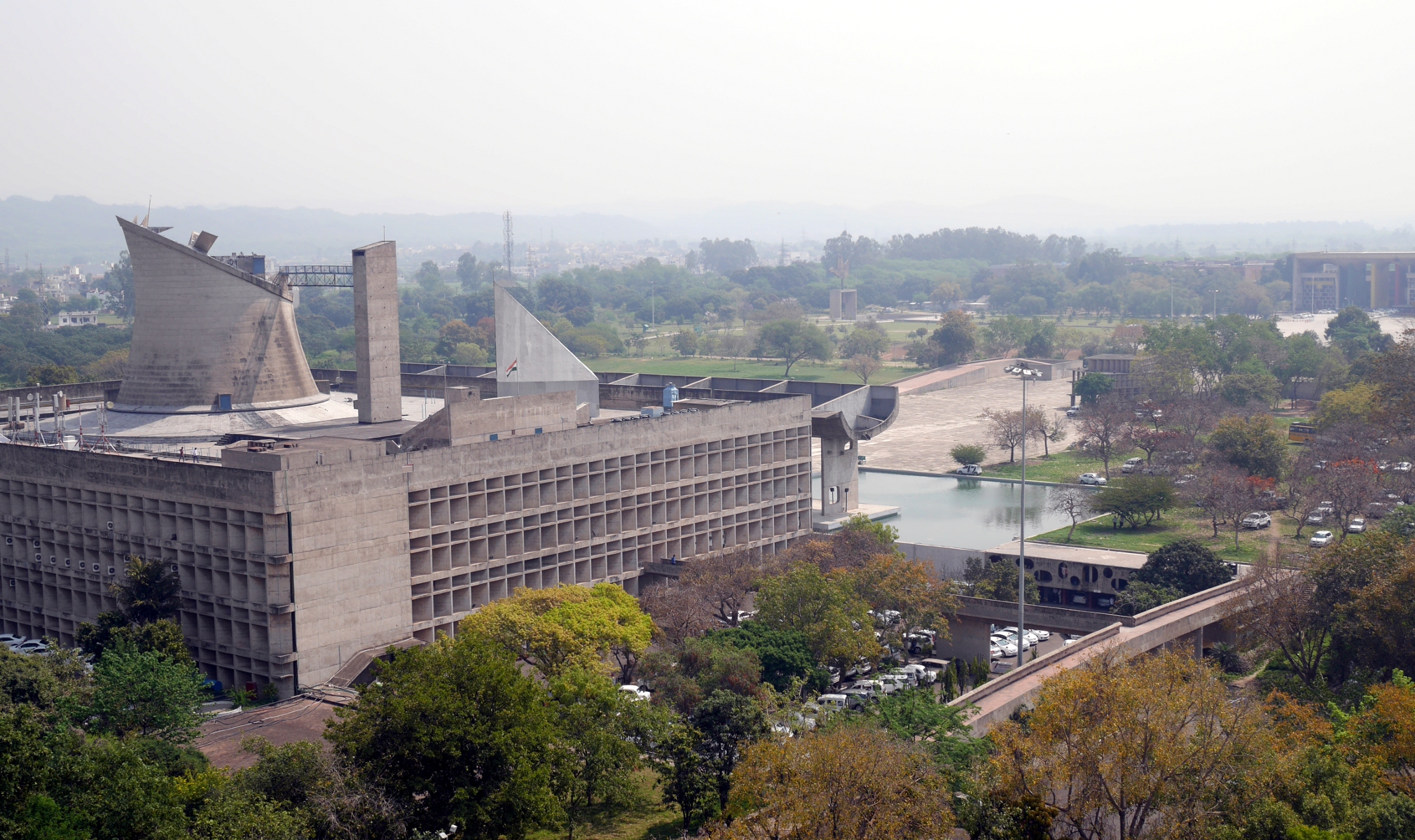
The Legislative Assembly in Chandigarh, designed by Le Corbusier.
I remember the first time I heard about Chandigarh, the planned capital of the Indian states of Punjab and Haryana. It was during my first sojourn in India, after I had already spent several months exploring the country. It was a long and boring Saturday afternoon, and I was looking at the Rough Guide to India. I came across the city map of Chandigarh, which has perfectly rectangular, uniformly-sized blocks. I thought: Huh? I was used to seeing Indian cities that had been laid out haphazardly, so how did Chandigarh get to be built on a grid?
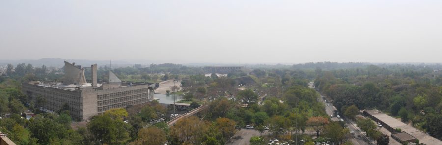
As I learned later, Chandigarh was built after Partition to replace Lahore, the traditional capital of Punjab, which was now in Pakistan. (At this time, Punjab and Haryana were a single state.) Prime Minister Nehru was in favor of building a totally modern capital for Punjab, to represent India’s arrival on the world stage as a modern nation. The individual who gets most of the credit for designing Chandigarh was the Swiss-born architect and prophet of modernism Le Corbusier. In reality, Le Corbusier was not the sole creator of Chandigarh, as he modified a town plan worked out earlier by the American architect Albert Mayer. The first phase of Le Corbusier’s plan, which ended up getting built with some further modifications, called for twenty-nine numbered sectors separated by huge landscaped boulevards. The state government buildings are in the Capitol Complex in Sector 1, and the main commercial district is Sector 17. Northeast of the city, in Sector 6, is a large city park centered around Sukhna Lake, an artificial lake impounded by a long embankment.
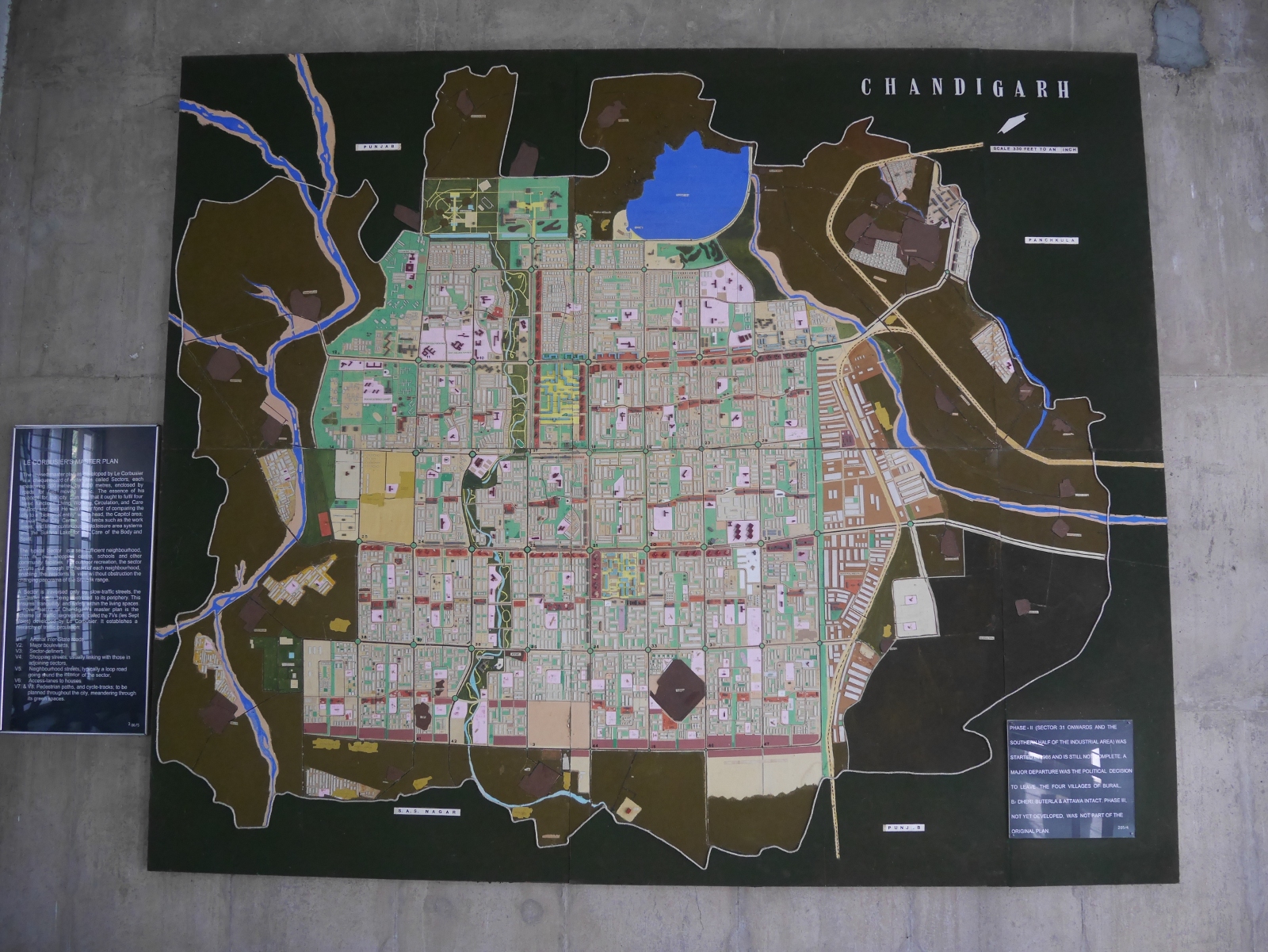
The town plan of Chandigarh, as portrayed in the city museum.
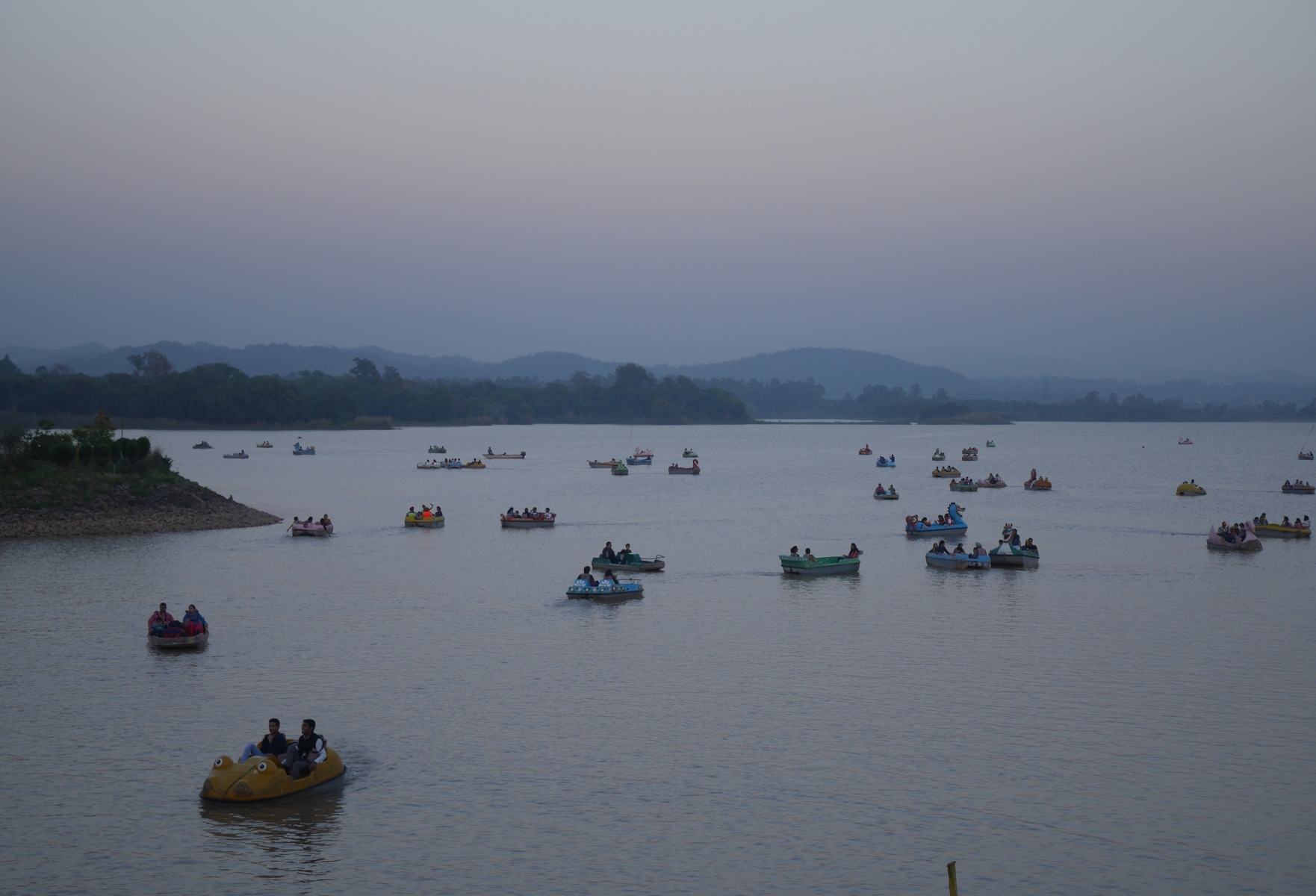
Paddleboats on Sukhna Lake.
Chandigarh has gained a certain notoriety for its unusual town plan. The scale of the city makes it impossible to get anywhere by walking. The population density is too low to support a metro, and the city buses run infrequently. More than anywhere else in India, the people of Chandigarh have to rely on private automobiles to get around their city. In fact, Chandigarh is the only place in India that has more registered motor vehicles than people. (This includes scooters and motorbikes as well as cars.) The shopping center at Sector 17 is so large and sparse that it is never crowded and bustling like the commercial districts of other Indian cities. James C. Scott devoted a couple of pages to Chandigarh in his seminal critique of authoritarian high-modernism, Seeing Like a State: How Certain Schemes to Improve the Human Condition Have Failed (1998). He included a black-and-white photo of Sector 17, which looks like a massive concrete wasteland with a few tiny human figures standing in it.
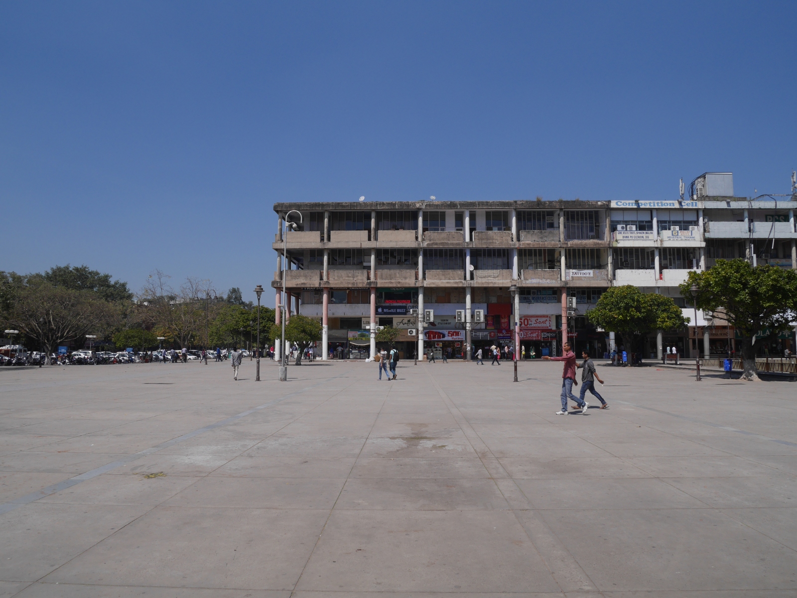
My attempt at recreating the photograph of Sector 17 in Scott’s Seeing Like a State.
Five years after first learning about Chandigarh, I have finally gotten a chance to visit the city. I could not draw any definitive conclusions about Chandigarh from a few short days there, but I did see enough to conclude that dire reports of the city’s poor planning and un-Indianness are exaggerated. While I do agree that it was foolish to make the city as big and spread-out as it is, it is still unmistakably an Indian city. Although private cars and motorbikes dominate the roads, there are also plenty of cycle rickshaws, autorickshaws, bicycles, and even horse carts. Sector 17 is a little bigger than it needs to be, but I feel that the austere photograph in Scott’s book misrepresents the place. It was likely taken early in the city’s life, before the place had had a chance to mature. In 2015, the shops around Sector 17 have brightly printed signs above them, like shops everywhere else in India. Far from being a concrete wasteland, the plaza in the middle of Sector 17 now has pipal trees and park benches in it.
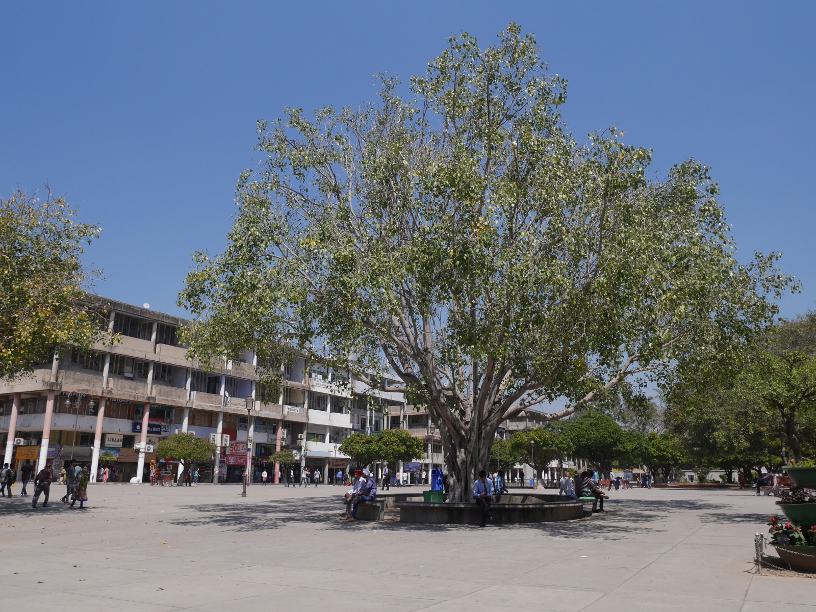
A pipal tree in Sector 17, Chandigarh.
Chandigarh is certainly unusual, but it is not exceptional in India. Planned towns in the Indian subcontinent date back to antiquity. Harappa and Mohenjo-Daro, two archaeological sites in present-day Pakistan, are the remains of two nearly identical cities built more than three thousand years ago. Although we know nothing about Harappan society, it is clear that they had a strong and centralized government that was able to enforce the town plan. Texts from later Indian antiquity describe the ideal city as a large square subdivided into square blocks, with the king’s palace in the central block. It is not clear whether such a city was actually constructed in antiquity, although the builders of Jaipur did follow the ancient guidelines when they laid out their city in the early eighteenth century.
The arrival of British colonists brought European-style town planning to India. Some Indian towns still have cantonment areas laid out in perfect grids for the British who once occupied them. Since independence, extensions of many existing Indian cities have been built on lines similar to Chandigarh. For example, Dwarka Sub-City in Delhi National Capital Territory was laid out by the Delhi Development Authority. (Other cities have similar agencies overseeing their expansions.) Dwarka is not built on a perfect grid, but it is built sector-by-sector with large streets separating the sectors. It does not seem to be a very efficient use of space. The Delhi Metro runs through Dwarka, but much of the sub-city is not convenient to the metro. The housing societies are built for people who own their own cars.
Apart from the scale, the most significant difference between Chandigarh and Dwarka is the underlying motive for construction. From start to finish, Chandigarh is infused with modernist ideology; it declares that India has arrived as a modern nation. Dwarka, on the other hand, is just a place for middle-class people to live.
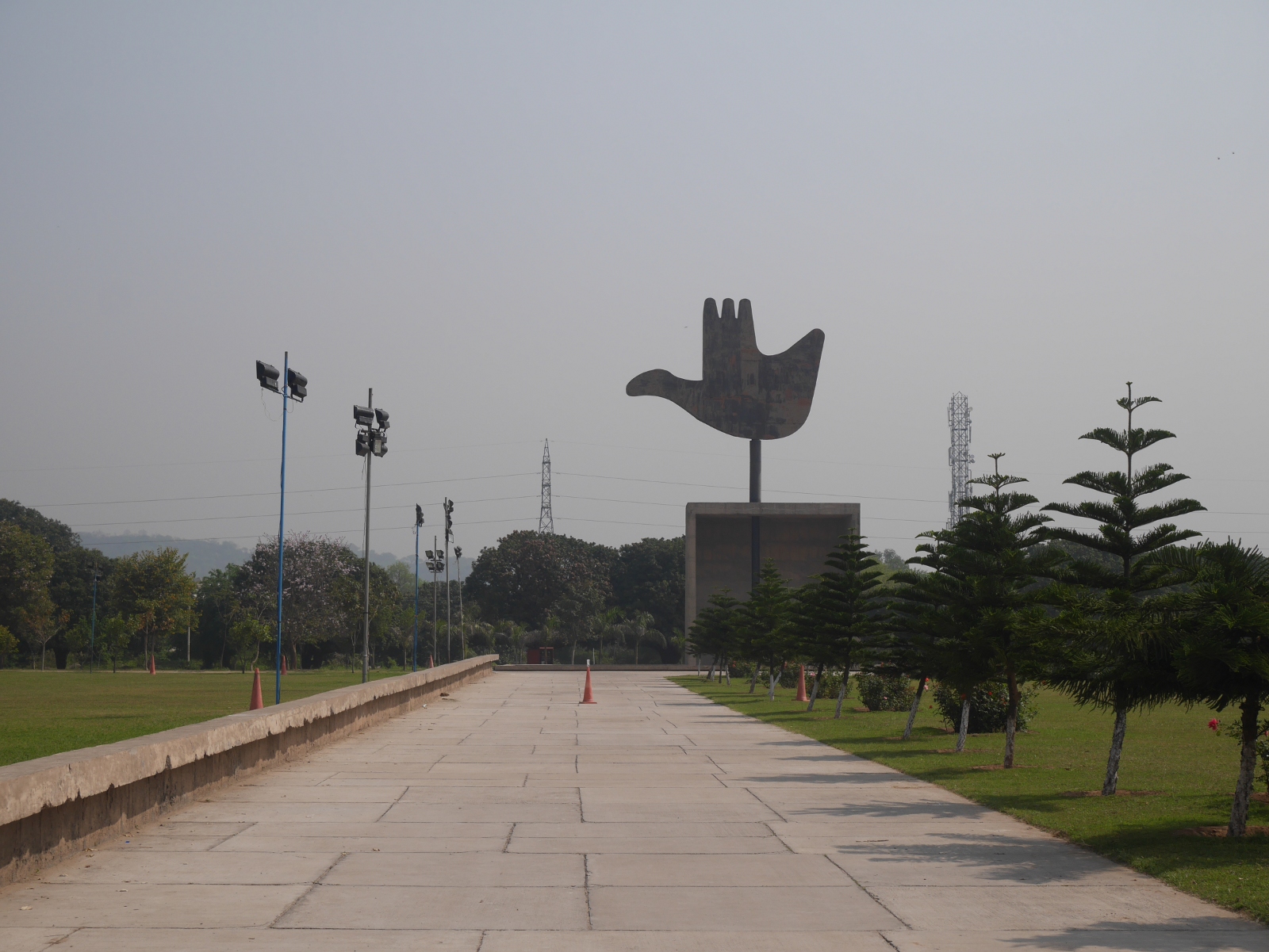
Chandigarh’s Open Hand Monument, designed by Le Corbusier but not constructed until 1985.