Quebec was colonized in the 17th century by France, a country that remained largely Catholic even as England, northern Germany, and other parts of Europe were turning Protestant. Like the mother-country, Quebec became Catholic. Protestants were not even allowed to settle there. Only after the British takeover of Canada in the mid-18th century was Protestantism even tolerated in Quebec.
In much more recent times, Catholic Church membership and attendance have dropped off sharply in Quebec, and many congregations have had to close their doors. The availability of deconsecrated church buildings has given rise to some intriguing examples of adaptive reuse. On a recent visit to Quebec, I saw one church that had been converted into a restaurant and another that was a fitness center. Neither use really makes sense to me, because they do not take advantage of the single large, enclosed space that is a hallmark of churches.
Decline in church membership is only one reason why churches might be converted to other uses or torn down. Another is urban redevelopment, which is carried out with particular ferocity on the land-hungry island of Montreal. Churches—along with many other buildings of historic value—disappear and are replaced by new construction.
But they don’t all disappear without a trace. On the corner of Viger and St. Denis streets, there stands a lonely church tower without a church. This is the tower of Trinity Anglican Church, built in 1865 and demolished in 2011 to make room for a giant new hospital, University of Montreal Health Centre. The tower was rebuilt in 2016, using the original stones. Even as the city is redeveloped, this memento of the past has been retained.
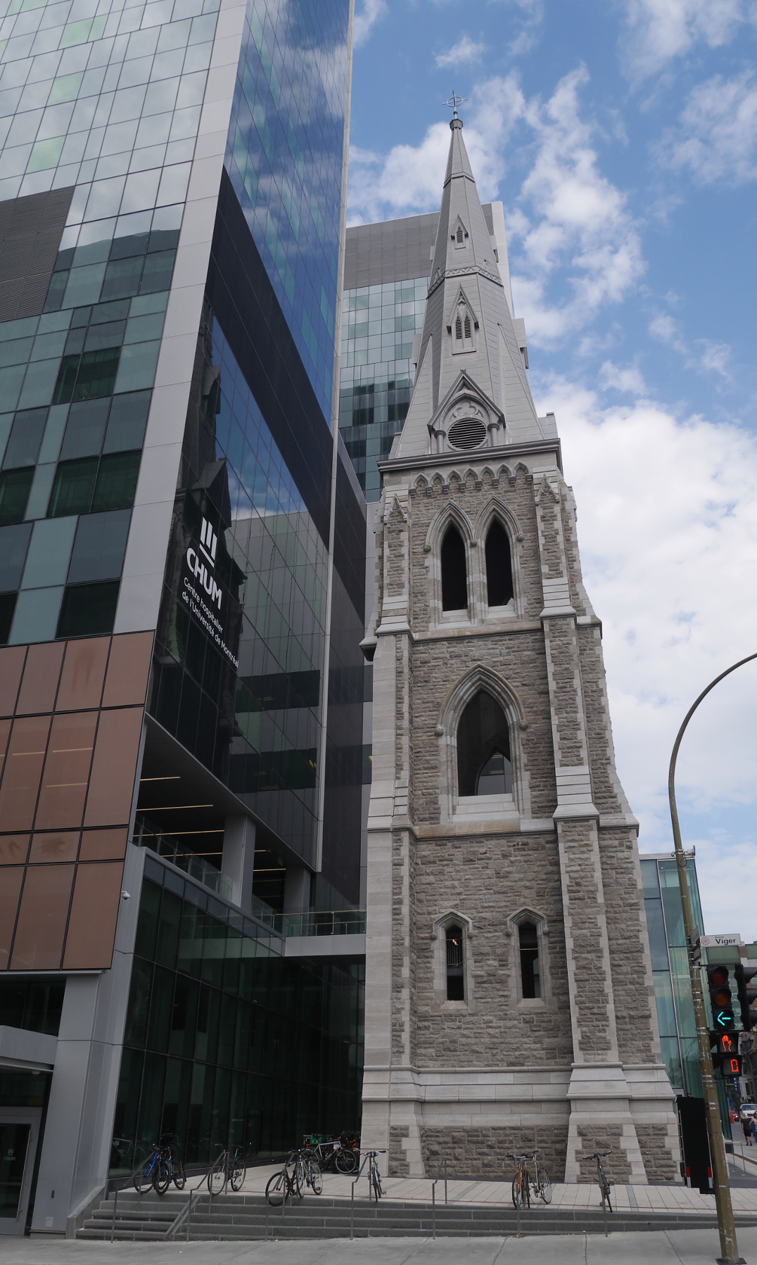
The reconstructed church tower of Trinity Anglican Church, next to University of Montreal Health Centre.
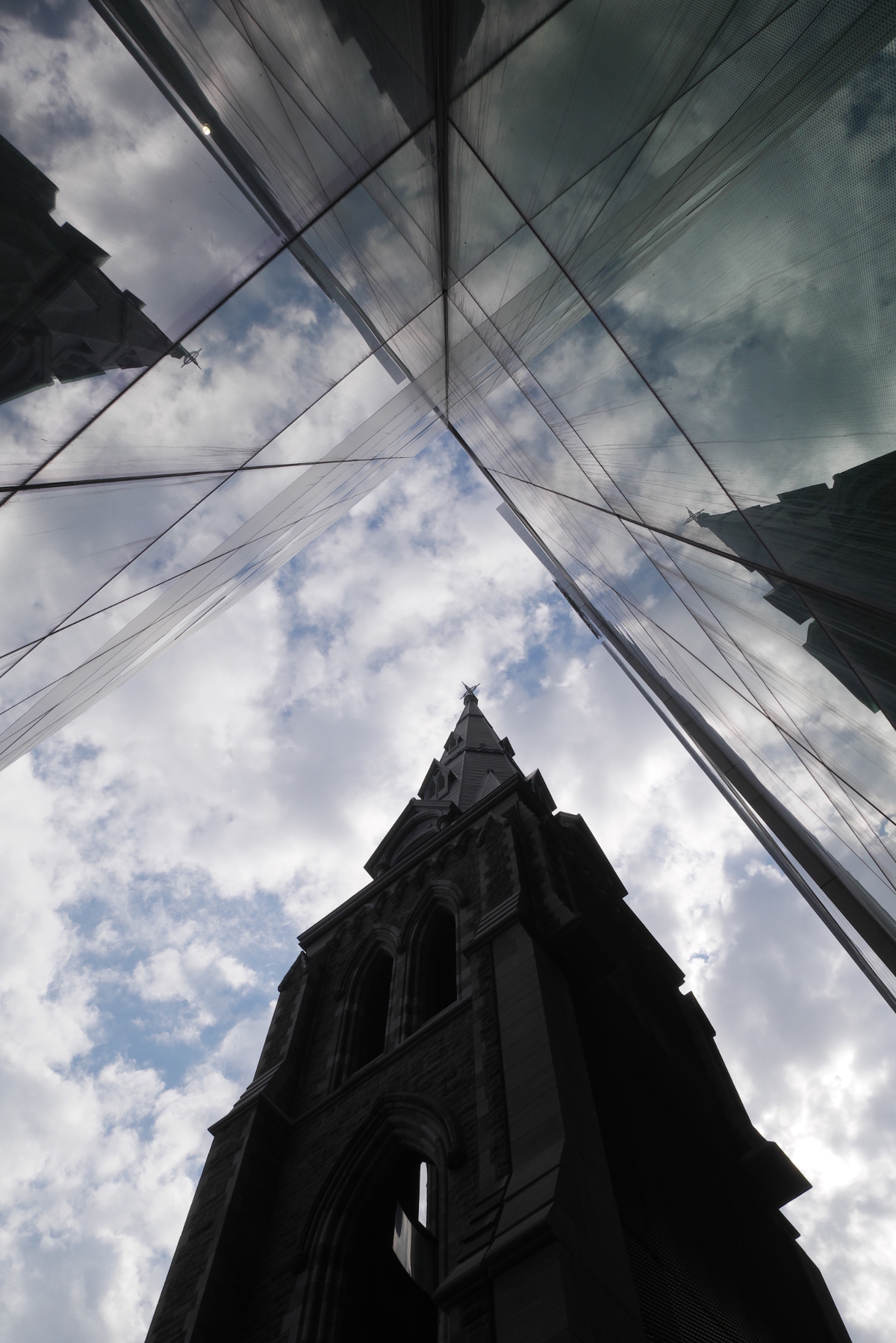
The Gothic church tower reflected in the glassy facade of the hospital.
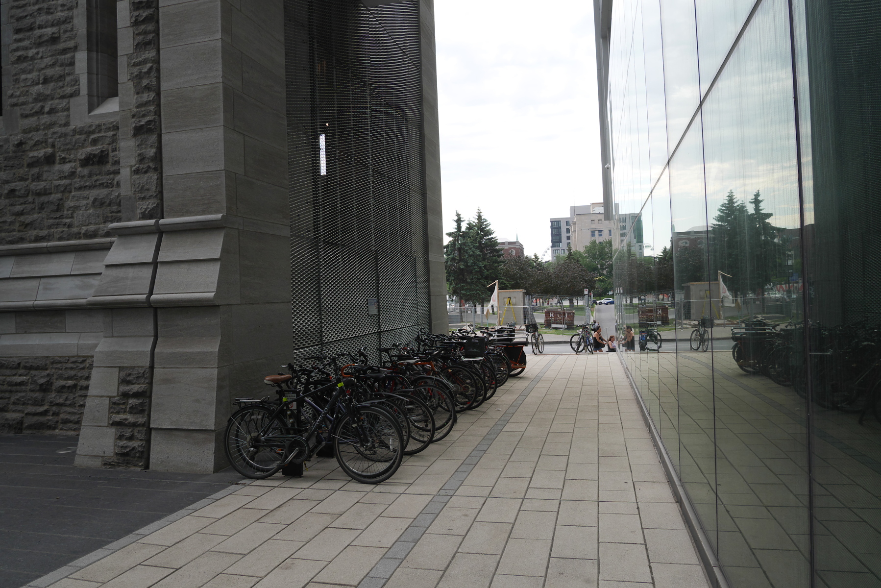
The backside of the tower is used for bicycle parking.
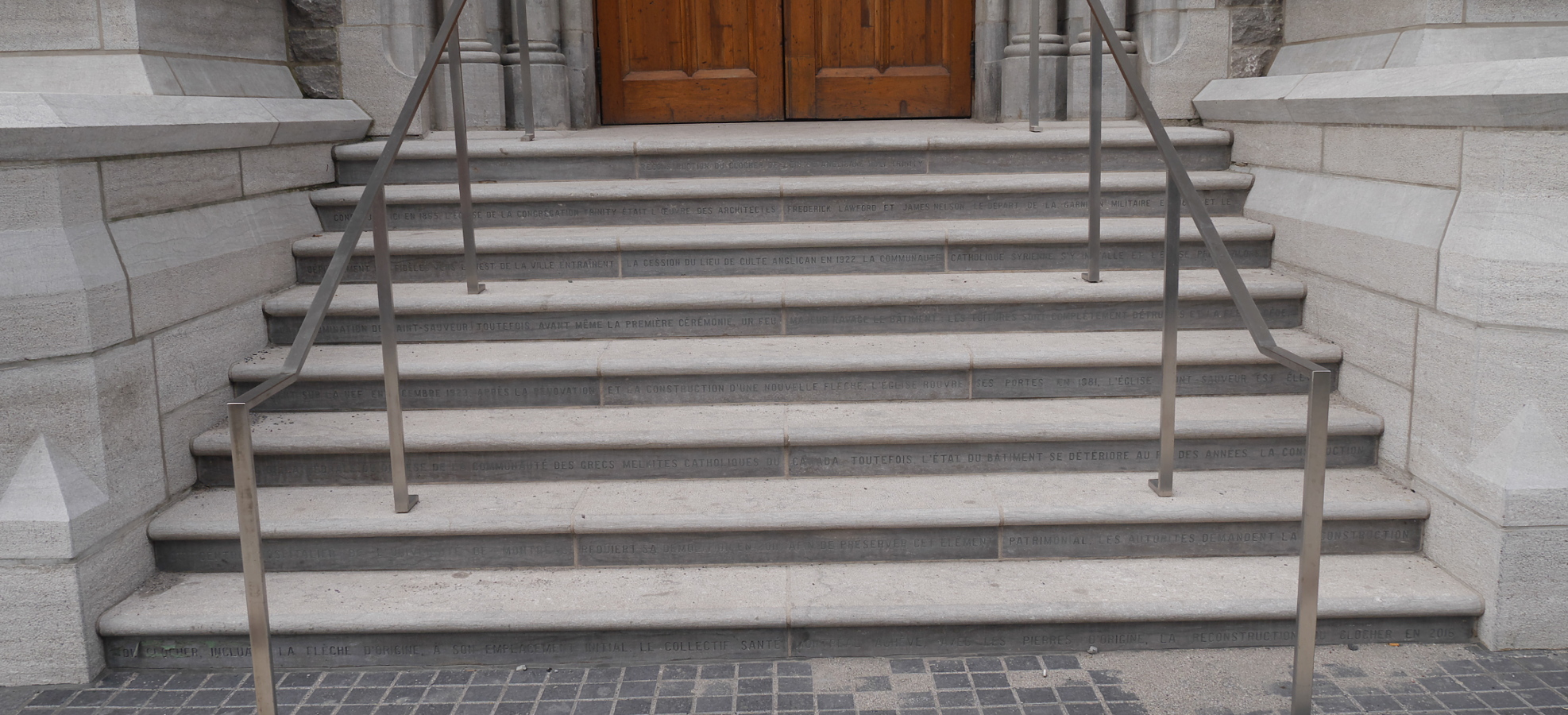
The story of Trinity Anglican Church (in French) is inscribed in the reconstructed steps below the doorway.
Vanishing Montreal blog has pictures of Trinity Anglican Church shortly before and during its demolition.