Coordinates: 40.22 N, 105.35 W
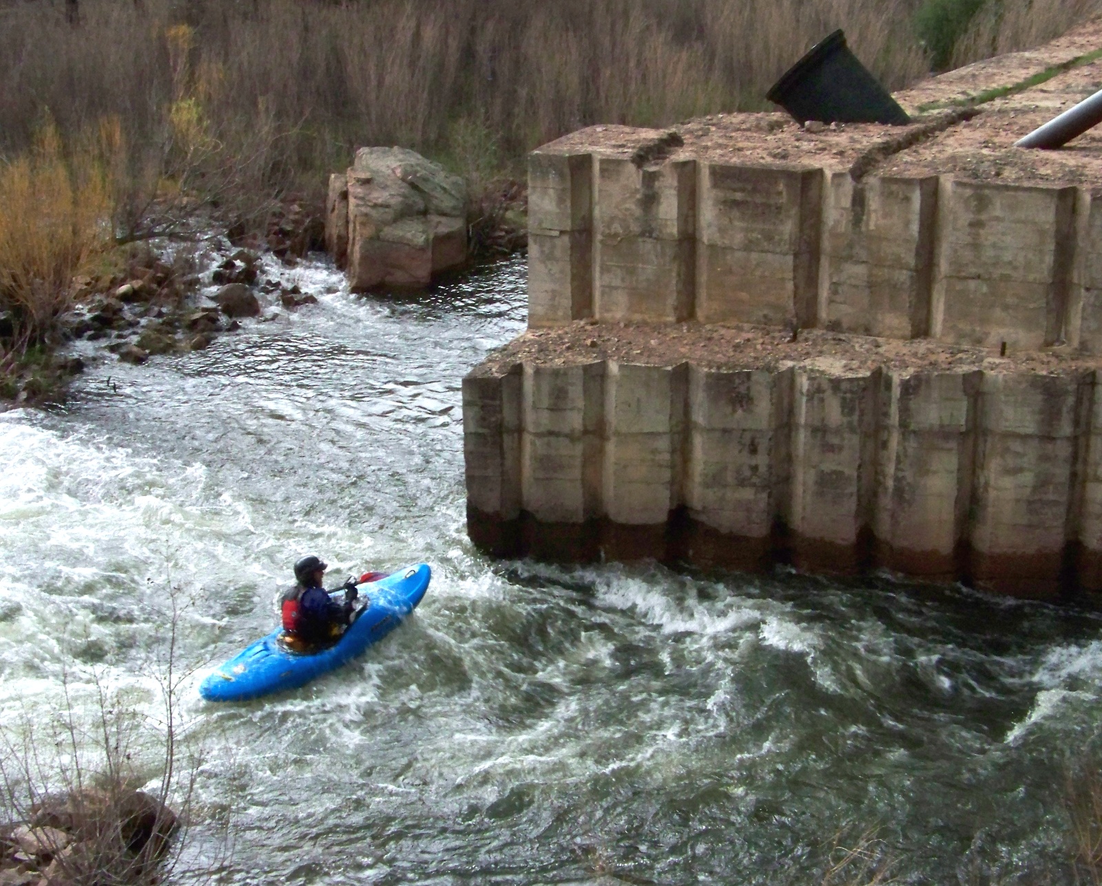
Kayaker passing Chimney Rock Dam.
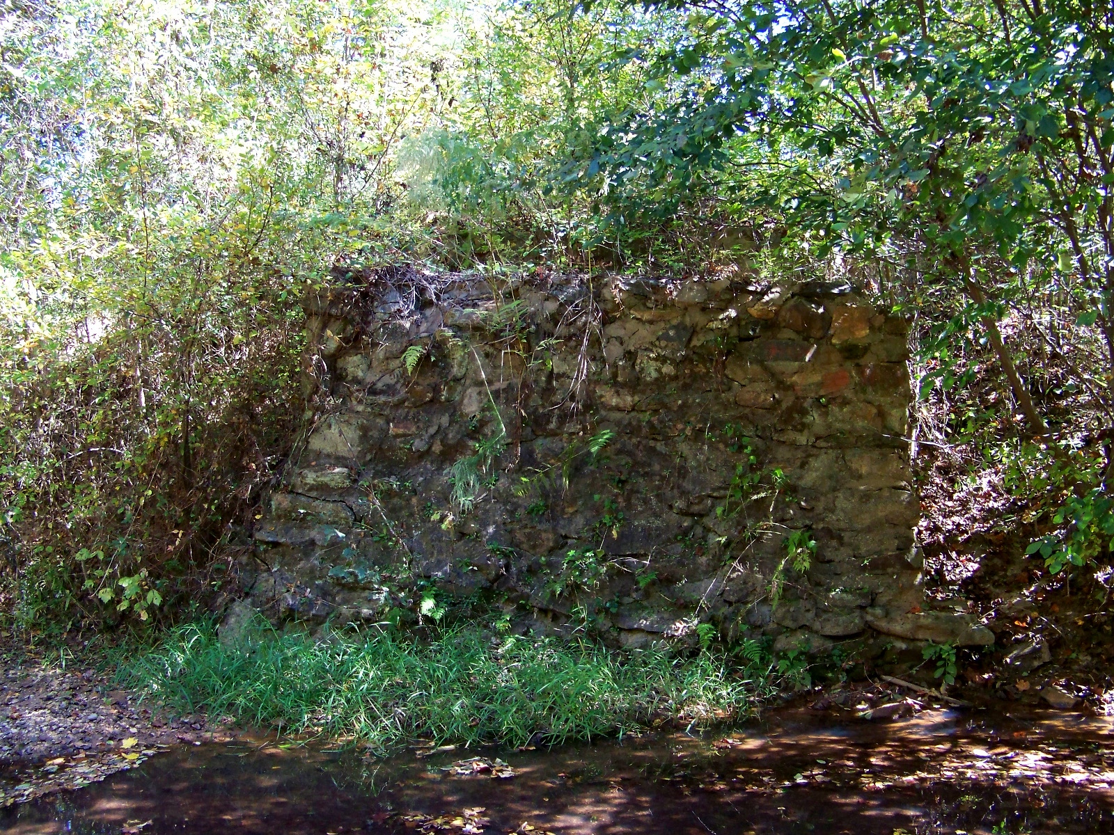
On the St. Vrain River in Colorado, a concrete structure juts partway into the stream, providing an obstacle to kayakers shooting down the rapids, but otherwise serving no useful purpose. The structure is the abandoned foundation of Chimney Rock Dam, a project that began and ended in the mid-1920s. Originally planned to be a combined hydropower and water storage project for the town of Longmont, the remains of Chimney Rock Dam now shed light on two quite different topics: early twentieth-century dam construction methods, and a brief chapter in Colorado’s political history.
Chimney Rock Dam was built with the use of cofferdams, a cheaper method than diverting the river, but a practical solution only for small or medium-sized streams. Cofferdams are wooden frames that workers fill with weights to sink in the river. Once they have completely surrounded a section of riverbed with a series of cofferdams, the workers pump the enclosed area dry and excavate the riverbed down to bedrock. Then they build the dam up layer by layer. When one section of the dam has risen to a reasonable height, the workers move on to the next section, which they built up from the riverbed out of cofferdams in the same manner as the first.
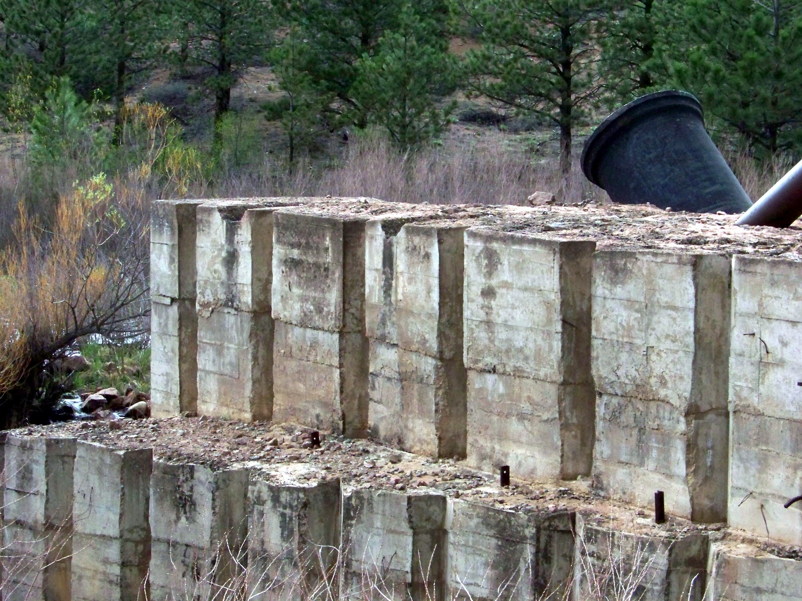
Detail of the concrete layers used to construct the dam.
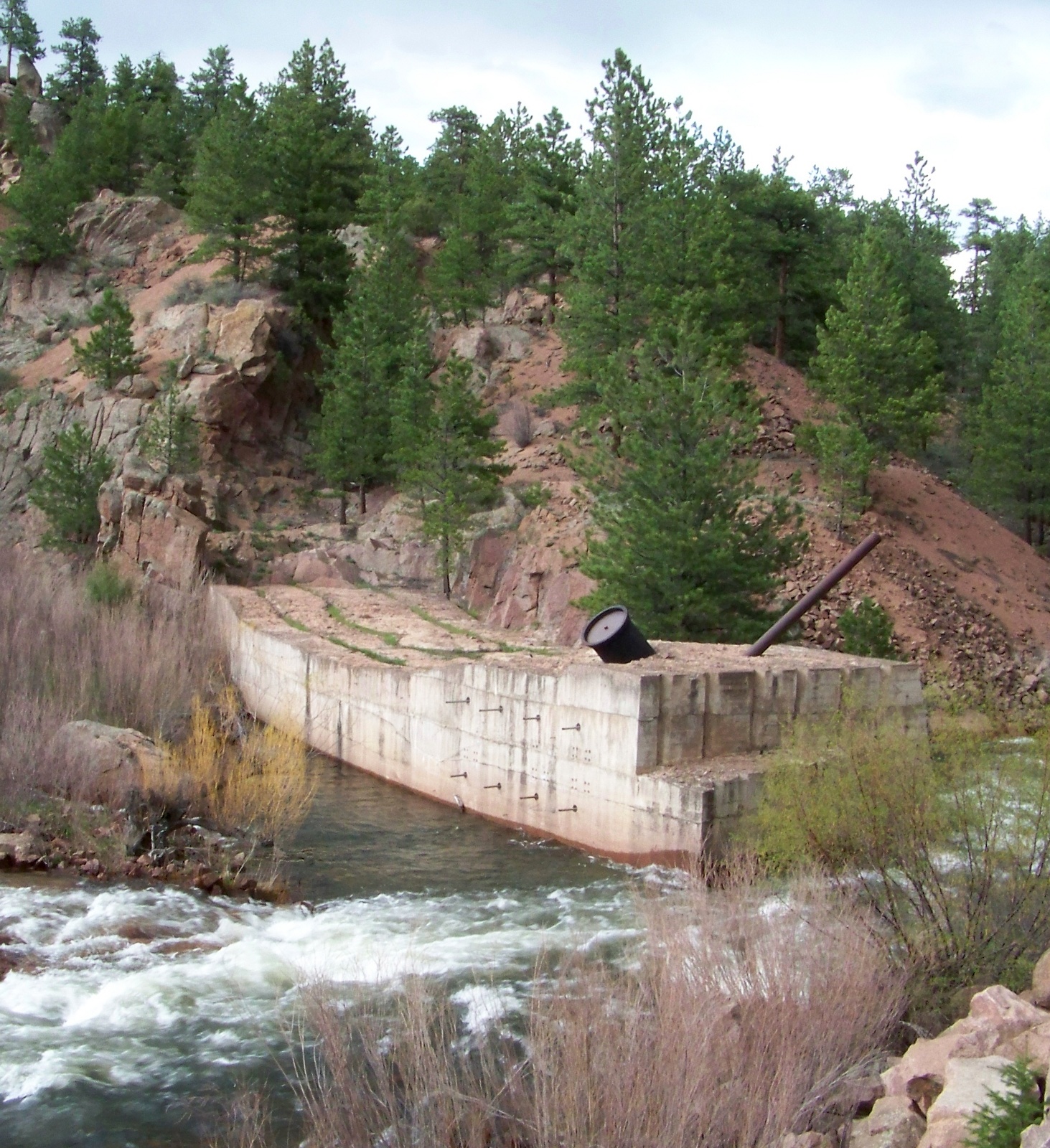
Backside of Chimney Rock Dam.
A dam built section-by-section from cofferdams has channels in its base, which allow the river to flow unimpeded under the structure during construction. Once the dam tops out, the holes at the base of the dam are closed with gates that drop into place. Then the reservoir begins to fill up behind the dam, exerting pressure on the gates and keeping them sealed tightly shut.
Work never progressed this far on Chimney Rock Dam. Before the dam had even made it across the stream, all work stopped on it. The reason why the dam was abandoned was ultimately political, although a US Army Corps of Engineers audit also determined that the project was technically unfeasible. The dam was a pet project of Longmont’s short-lived Ku Klux Klan city government. Voted into office in the 1925 local elections, the Klan government initiated Chimney Rock Dam in 1926. During its short period of construction, the estimated final cost of the project ballooned from $85,000 to $350,000. Because of these and other excesses, Longmont’s Klan government quickly grew unpopular. Voters ousted the Klan from city government in the 1927 local elections.
What was the Klan doing in Colorado? Longmont’s brief electoral flirtation with the KKK was part of a major revival of the Klan during the 1920s. The first incarnation of the Klan had been based in the South during Reconstruction. The new Klan was reconstituted with its geographical center in the Midwest. During this period, the strongest Klan state was the thoroughly midwestern Indiana. The new Klan persecuted any group that they deemed different and un-American. In Colorado, they targeted Catholics and Mexicans.
Sixty years after the abandonment of Chimney Rock Dam, Longmont finally got its own major dam for water storage on the St. Vrain River. Button Rock Dam, just upstream from Chimney Rock, was dedicated in 1969. Holding 16,084 acre-feet of water in its reservoir, the dam cost $5.2 million to build.
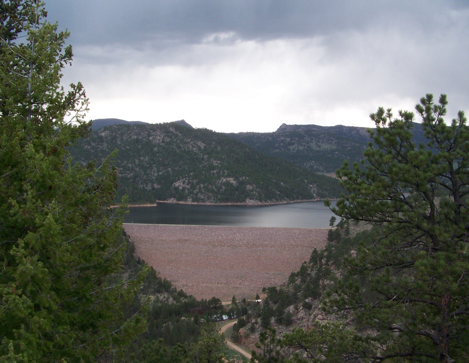
Button Rock Dam and Ralph Price Reservoir.