WillyLogan.com

Technology, History, and Place

Category: Dams (Page 2 of 2)

jaisamand-lake-pan

Jaisamand, Mewar’s superlative lake

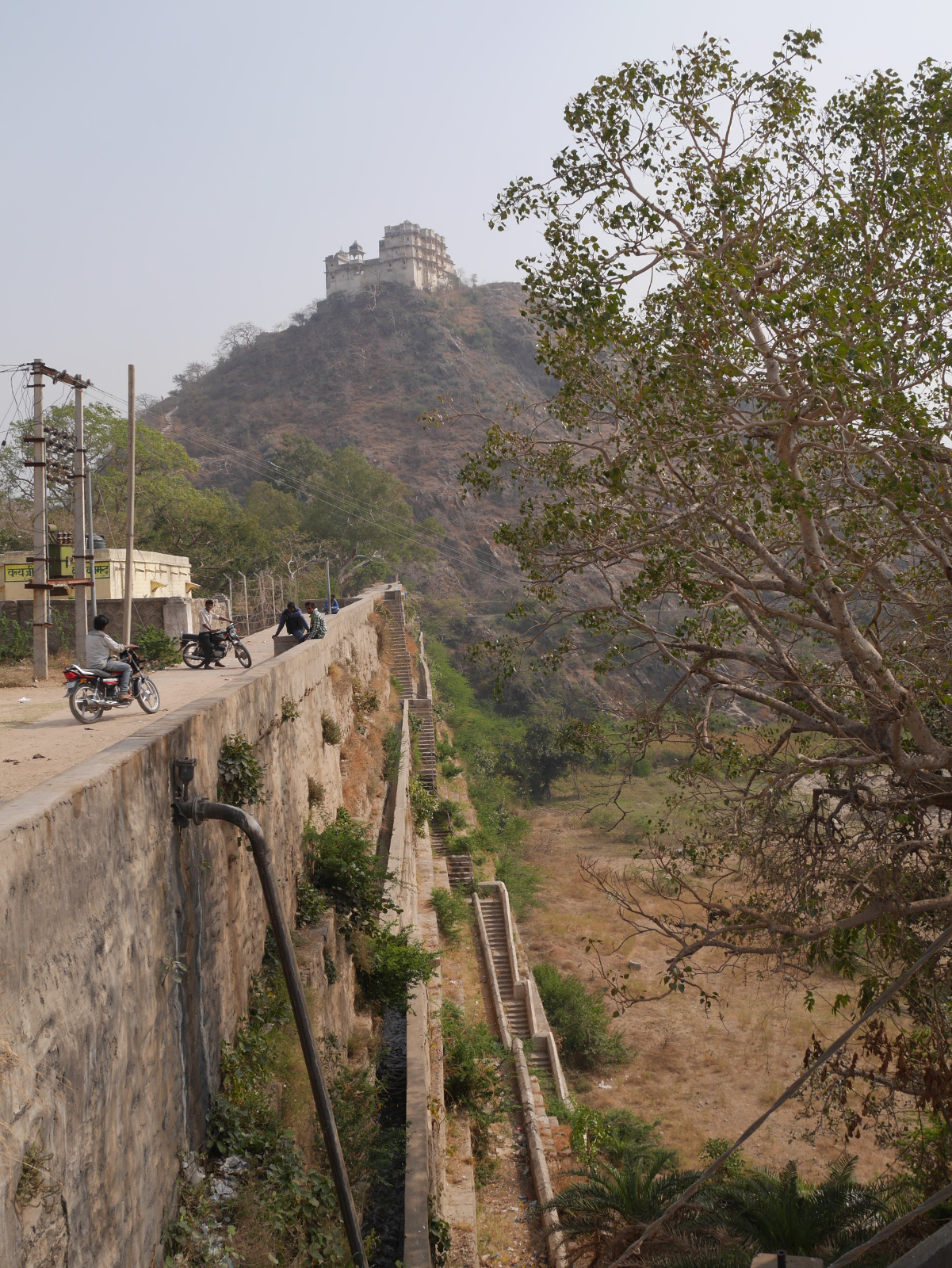
View of the ornamented backside of Jaisamand Dam.

View of the ornamented backside of Jaisamand Dam.

In southern Rajasthan, thirty miles south of the city of Udaipur, twenty square miles of the Aravalli Mountains have been flooded by the remarkable Jaisamand Lake, formed by the 1500-ft Jaisamand Dam. Tourist guidebooks frequently erroneously refer to Jaisamand as the second-largest artificial lake in Asia. This is far from the truth; in India alone, a half-dozen artificial lakes are much larger than Jaisamand. What is remarkable about Jaisamand is the combination of its size and its age. The lake was built in 1685 on behalf of Maharana Jai Singh of Mewar. Jaisamand holds the undisputed distinction of being the largest extant pre-modern artificial lake in India.

Of the numerous Rajput kingdoms in medieval western India, Mewar was the last to submit to the Mughal Empire. In 1568, Mewar lost its capital Chittaurgarh to the army of Akbar after a long and bloody siege, but a royal remnant escaped to found a new capital at Udaipur. The Mughals tried to defeat Mewar again at the epic Battle of Haldighati in 1576, but Maharana Pratap Singh escaped with his life and his kingdom. (Alas, Pratap’s horse Chetak succumbed to his injuries during the battle, but he has since become a local hero in his own right.) Finally, in 1615, after a series of battles, Maharana Amar Singh was forced to accede to the Mughal Empire. This was more than fifty years after Amber became the first Rajput state to join the empire.

After getting dragged into the Mughal Empire, Mewar could redirect some of its resources from militarization to infrastructural development. Jaisamand Lake was one of the public works projects undertaken in the post-accession period. The lake stored water from the Gomti River, for use in irrigation. It also provided a setting for palaces and royal hunting reserves.

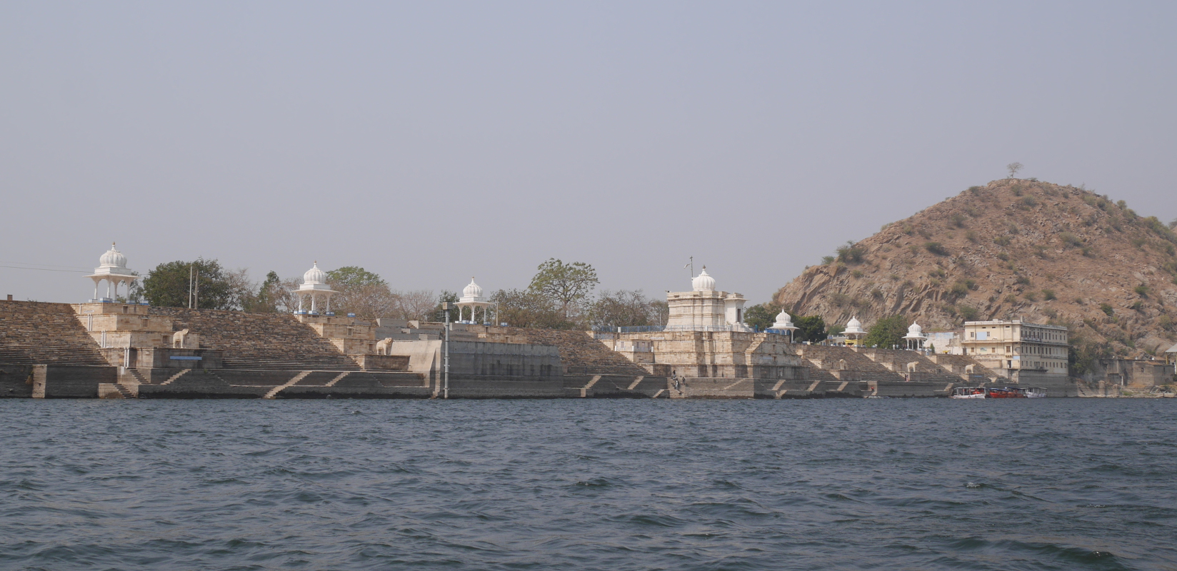
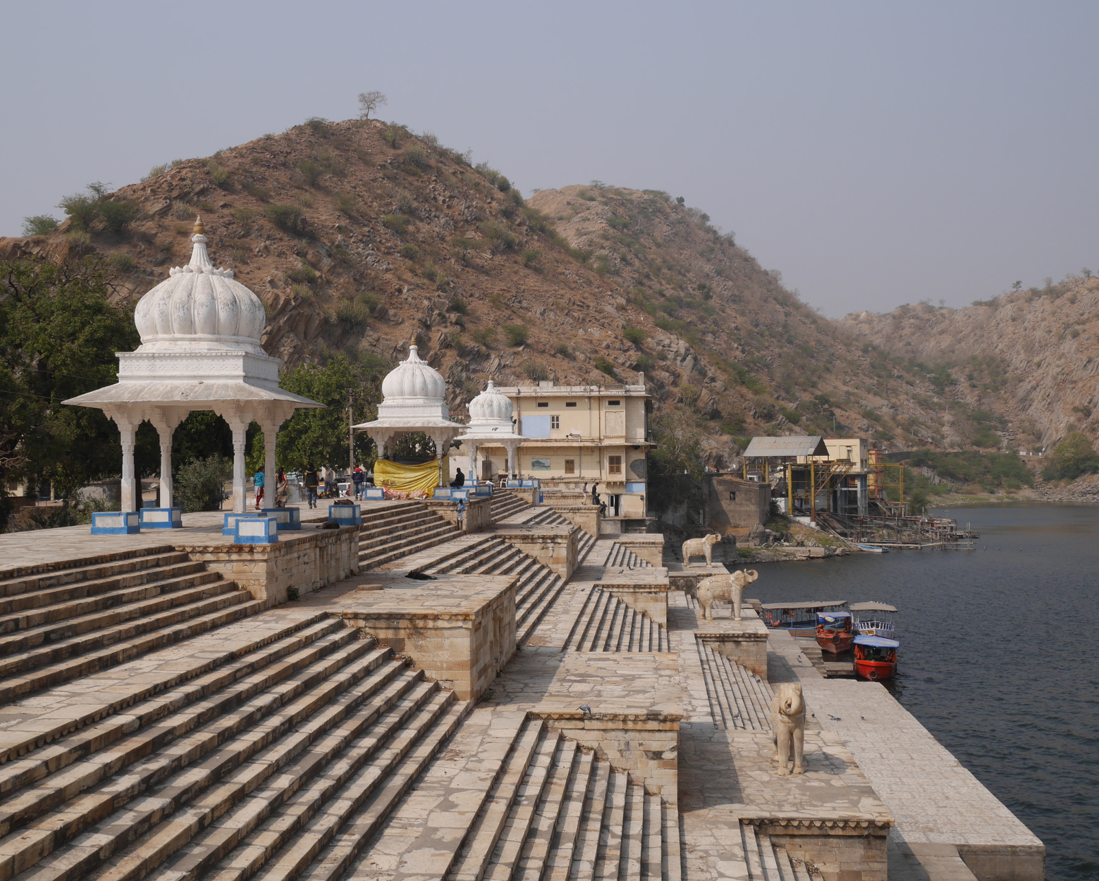
Jaisamand Lake has changed a little since the late seventeenth century. The original dam was refurbished around 1960. During the refurbishment, the historic front face of the dam was covered by a characterless concrete facade. The crest and backside of the dam, though, retain their historical appearance. A series of white marble steps lead down to the water. There are six stone chhatris (domed pavilions), six carved marble elephants, and a temple, Shri Narbdeshwar Mahadev Jaisamand. Despite some graffiti on the elephants, and the usual litter, Jaisamand Dam remains a place of historical importance and real beauty.
The steps on the backside of Jaisamand Dam.

The steps on the backside of Jaisamand Dam.

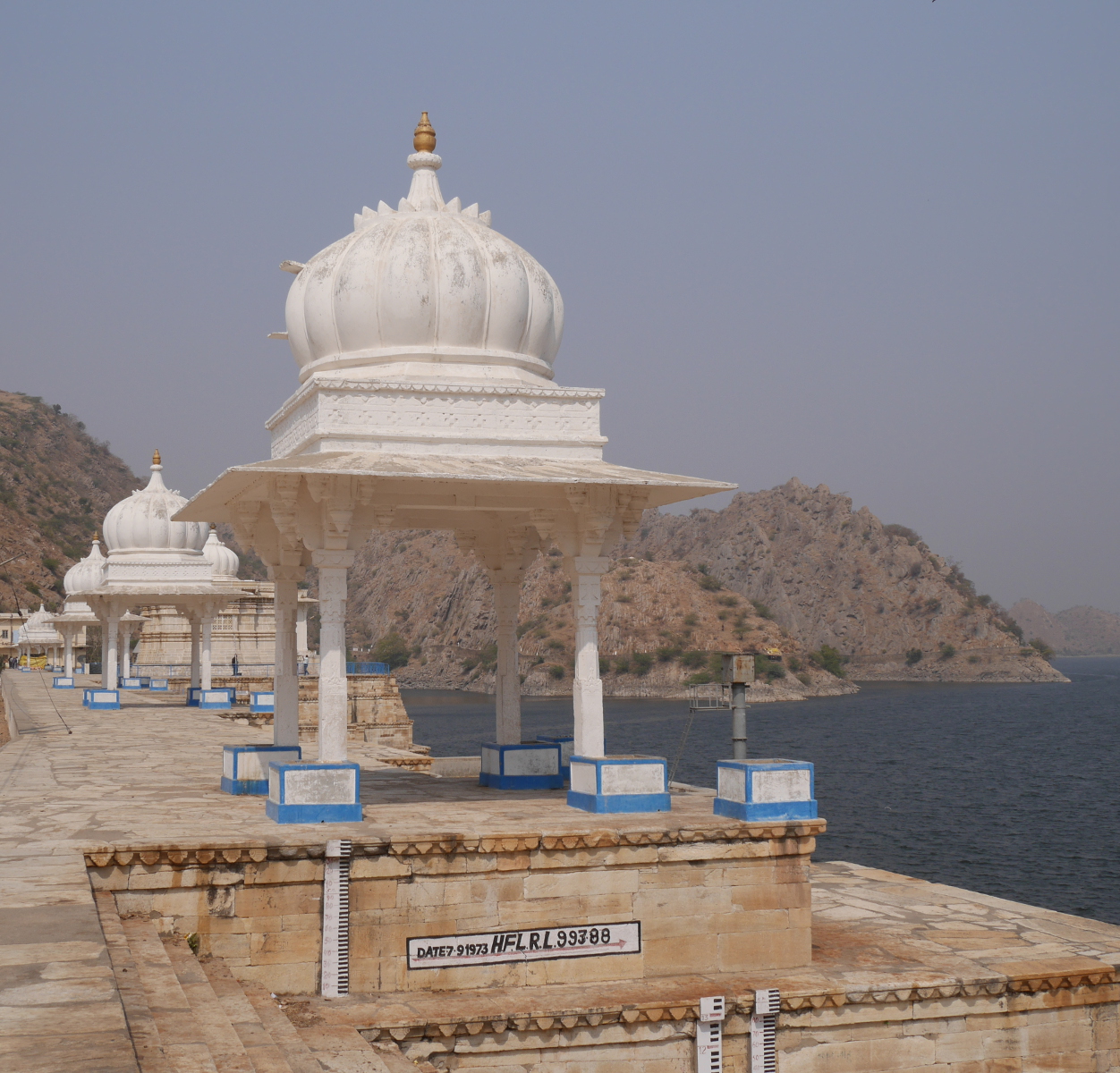
One of the chhatris on Jaisamand Dam. The white mark underneath the chhatri indicates the level reached by a flood in 1973.
One of the chhatris on Jaisamand Dam. The white mark underneath the chhatri indicates the level reached by a flood in 1973.

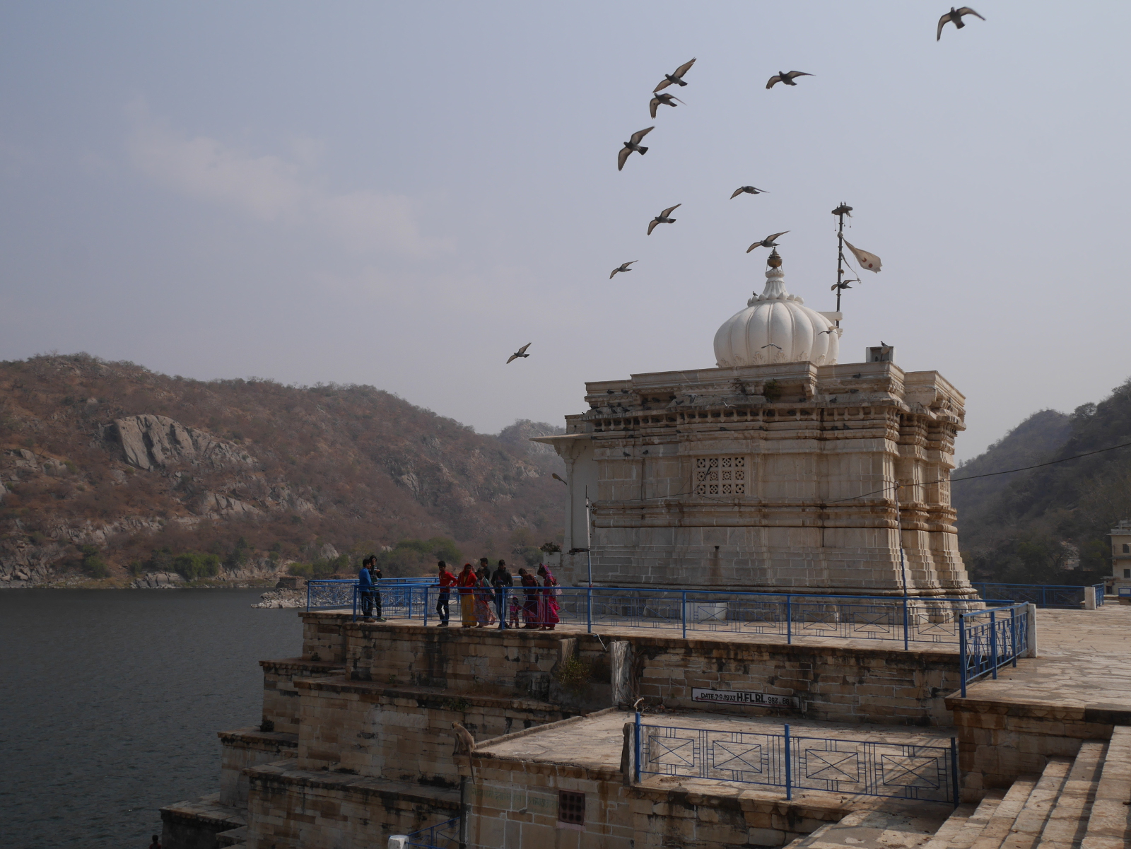
Pigeons fly over Shri Narbdeshwar Mahadev Jaisamand Temple, located front and center on Jaisamand Dam.

Pigeons fly over Shri Narbdeshwar Mahadev Jaisamand Temple, located front and center on Jaisamand Dam.

The characterless concrete face of the refurbished Jaisamand Dam.

The characterless concrete face of the refurbished Jaisamand Dam.

Jaisamand is accessible from Udaipur by Banswara-bound bus from the main government bus terminal near Udaipol. The dam and the lake are just up the hill from Jaisamand town, where the bus stops. Boat rides are available from the dam, at Rs 600 per boat for a half-hour or Rs 1200 for the full hour. On a hill just above the dam, a ruined palace stands on forest department land. Visitors can get permission to climb up to the palace from the forest department office, with payment of a fee. I thought the rate for foreigners of Rs 300 was ridiculously steep – even without the additional Rs 900 camera fee – so I opted out of that experience.
For further coverage of India’s pre-modern artificial lakes, please see my posts “Goodly Lakes” and “Another Goodly Lake.

jal-mahal-pan

Goodly Lakes

“Indeed, these Indian Lakes are goodly things, and may be reckon’d amongst the most remarkable structures in the world.” – Pietro della Valle (seventeenth-century Italian traveler to India)

Early-modern European travelers to India were unanimously impressed by the civil engineering works that they saw there, particularly artificial lakes and irrigation systems. I am impressed by these works as well. In the current post, I will explain the historical background of some of the artificial lakes and tanks that I have come across in my explorations of western India.

Jal Mahal Sagar is a roughly circular lake just north of the city of Jaipur. The lake takes its name from Jal Mahal (“Water Palace”), a picturesque structure that rises out of the lake near the southwestern shore. Even the dam that impounds the lake is picturesque; it is crenelated like the wall of a Rajput fortress. (See “Batman Goes to India” for a description of Rajput architecture.) The lake had a practical purpose beyond providing a location for the water palace: storing water in order to sure that the city of Jaipur received a reliable supply. Jal Mahal Sagar was an integral part of the original plan of Jaipur when the city was constructed in the 1720s.1

Hilltop view of Jal Mahal Sagar.

Hilltop view of Jal Mahal Sagar.

Jal Mahal, just outside of Jaipur.

Jal Mahal, just outside of Jaipur.

View of the fortresslike dam of Jal Mahal Sagar.

View of the fortresslike dam of Jal Mahal Sagar.

Some artificial lakes have since found uses that their builders did not intend. Take for example the Padam Talao, which now falls within the protected area of Ranthambhore National Park, a tiger reserve in eastern Rajasthan. The park’s crocodiles and deer drink from and wallow in the lake. Humans are not allowed in the water.

Padam Talao, in Ranthambhore National Park.

Padam Talao, in Ranthambhore National Park.

Smaller than artificial lakes are tanks. Whereas lakes fill a pre-existing valley behind a dam, tanks are intentionally dug into the ground. Since they do not have to follow the local topography, tanks can be made in whatever shape the builder pleases. Many of them are built with rectangular plans, which I think reflects the Hindu conception of an ordered world and cosmos (as also reflected by the rectangular street plan of Jaipur). It is not the result of European influence.

An exemplary tank is the Sagar, located behind the city palace in Alwar. According to the descriptive plaque at the site, the tank was originally dug in the eighth or ninth century, then rebuilt in its present form in 1813 by Maharaja Bakhtawar Singh Ji. The tank is a perfect rectangle, surrounded by steps descending to the water on all sides. Twelve domed pavilions rise from the edge of the water. Today, the water is overgrown with algae, but people still come to the tank to feed the fish that manage to live in the water.

View of Alwar Sagar.

View of Alwar Sagar.

Hilltop view of Alwar Sagar.

Hilltop view of Alwar Sagar.

  1. Giles Tillotson, Jaipur Nama: Tales from the Pink City (New Delhi: Penguin Books, 2006), 20. []

The Klan’s Dam

Coordinates: 40.22 N, 105.35 W

Kayaker passing Chimney Rock Dam.

Kayaker passing Chimney Rock Dam.

On the St. Vrain River in Colorado, a concrete structure juts partway into the stream, providing an obstacle to kayakers shooting down the rapids, but otherwise serving no useful purpose. The structure is the abandoned foundation of Chimney Rock Dam, a project that began and ended in the mid-1920s. Originally planned to be a combined hydropower and water storage project for the town of Longmont, the remains of Chimney Rock Dam now shed light on two quite different topics: early twentieth-century dam construction methods, and a brief chapter in Colorado’s political history.

Chimney Rock Dam was built with the use of cofferdams, a cheaper method than diverting the river, but a practical solution only for small or medium-sized streams. Cofferdams are wooden frames that workers fill with weights to sink in the river. Once they have completely surrounded a section of riverbed with a series of cofferdams, the workers pump the enclosed area dry and excavate the riverbed down to bedrock. Then they build the dam up layer by layer. When one section of the dam has risen to a reasonable height, the workers move on to the next section, which they built up from the riverbed out of cofferdams in the same manner as the first.

Detail of the concrete layers used to construct the dam.

Detail of the concrete layers used to construct the dam.

Backside of Chimney Rock Dam.

Backside of Chimney Rock Dam.

A dam built section-by-section from cofferdams has channels in its base, which allow the river to flow unimpeded under the structure during construction. Once the dam tops out, the holes at the base of the dam are closed with gates that drop into place. Then the reservoir begins to fill up behind the dam, exerting pressure on the gates and keeping them sealed tightly shut.

Work never progressed this far on Chimney Rock Dam. Before the dam had even made it across the stream, all work stopped on it. The reason why the dam was abandoned was ultimately political, although a US Army Corps of Engineers audit also determined that the project was technically unfeasible. The dam was a pet project of Longmont’s short-lived Ku Klux Klan city government. Voted into office in the 1925 local elections, the Klan government initiated Chimney Rock Dam in 1926. During its short period of construction, the estimated final cost of the project ballooned from $85,000 to $350,000. Because of these and other excesses, Longmont’s Klan government quickly grew unpopular. Voters ousted the Klan from city government in the 1927 local elections.

What was the Klan doing in Colorado? Longmont’s brief electoral flirtation with the KKK was part of a major revival of the Klan during the 1920s. The first incarnation of the Klan had been based in the South during Reconstruction. The new Klan was reconstituted with its geographical center in the Midwest. During this period, the strongest Klan state was the thoroughly midwestern Indiana. The new Klan persecuted any group that they deemed different and un-American. In Colorado, they targeted Catholics and Mexicans.

Sixty years after the abandonment of Chimney Rock Dam, Longmont finally got its own major dam for water storage on the St. Vrain River. Button Rock Dam, just upstream from Chimney Rock, was dedicated in 1969. Holding 16,084 acre-feet of water in its reservoir, the dam cost $5.2 million to build.

Button Rock Dam and Ralph Price Reservoir

Button Rock Dam and Ralph Price Reservoir.

Page 2 of 2

Powered by WordPress & Theme by Anders Norén