Immediately under the south end of the Golden Gate Bridge stands Fort Point, a US Army fortress that protected the approach to San Francisco Bay during the Civil War. Fort Point is one of the best-preserved coastal defense forts of its era, and one of the few major sites of Civil War significance on the West Coast.
The Army built Fort Point as part of the Third System of Coastal Fortifications, which were built between the end of the War of 1812 and the beginning of the Civil War. Most of the Third System forts were built on the Atlantic and Gulf Coasts. When I lived in Alabama in grad school ten years ago, I visited several Third System forts; some of my pictures of those forts appear in this video.
While I enjoyed visiting those forts, I was disappointed to find that many of them had ugly concrete batteries from a later era, the Endicott System, built right inside them. Not even iconic Fort Sumter, where the Civil War began, was spared this fate! But Fort Point didn’t have any concrete gun batteries built inside it, as there were plenty of more convenient sites for the big guns elsewhere on the Golden Gate (and they probably wouldn’t have fit anyway). Although Fort Point is hardly in pristine condition (all of its original guns are missing, and the fort was modified in an abortive attempt to convert it into a second prison like Alcatraz), the fort is substantially complete, and it is easier to envision how it was used in the 1800s than it is while visiting many other Third System forts.
When researching this video, I found no shortage of secondary source material about Third System forts in general and Fort Point in particular. Some of this material was produced by the National Park Service for its own use in maintaining and interpreting the site. Another very useful source was (surprisingly) a Master’s thesis from the U.S. Army Command and General Staff College at Fort Leavenworth, Kansas, which provided a wide-angle view of Third System forts that other secondary source material lacked.
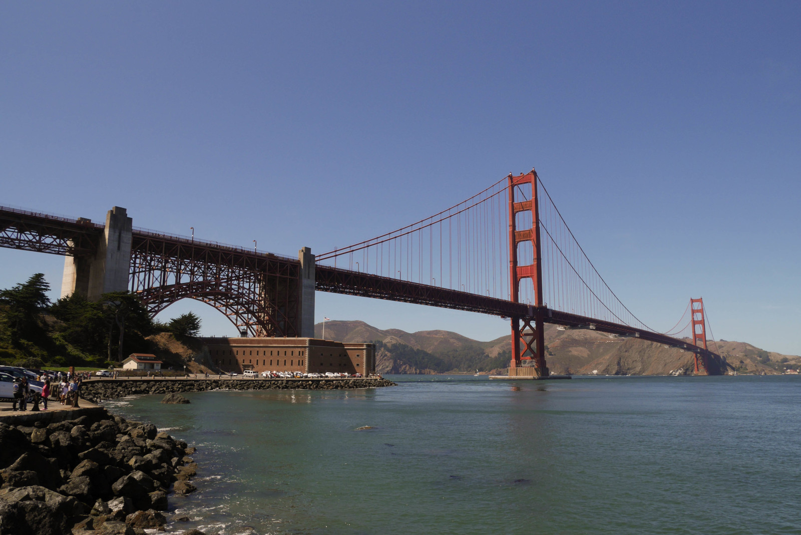
Fort Point is nestled under the southern end of the Golden Gate Bridge. It is easy to miss, but well worth taking the time to pay it a visit if you are in San Francisco.
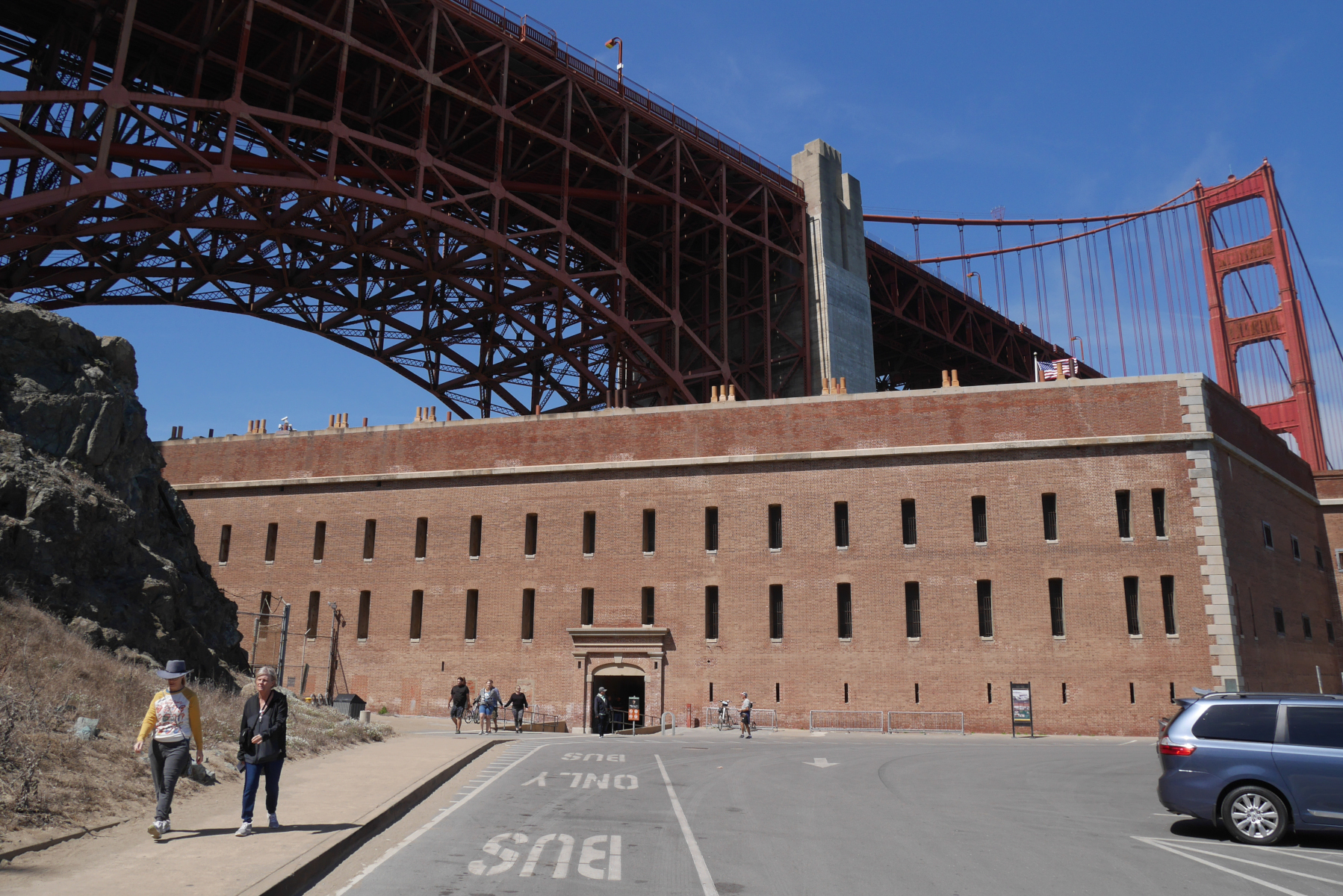
The southern or scarp wall of the fort, which was the only wall that did not face the ocean.
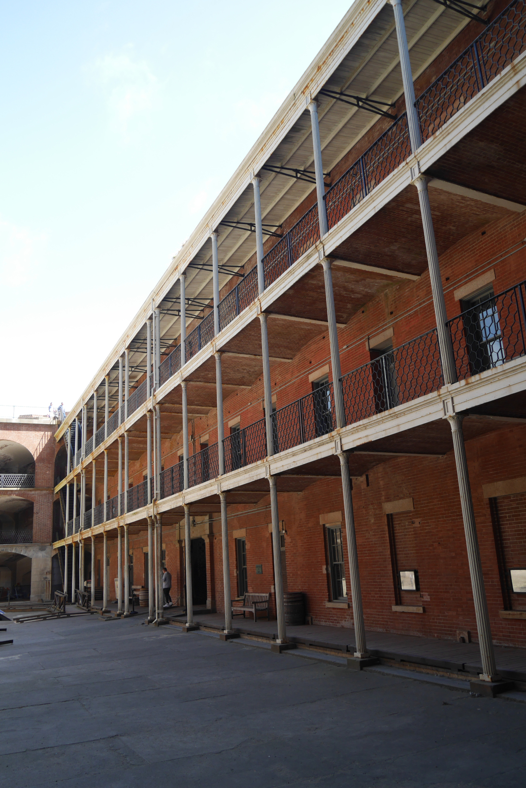
The gorge wall in the interior of the fort, on the same side as the scarp wall. This is where the officers and enlisted men had their quarters.
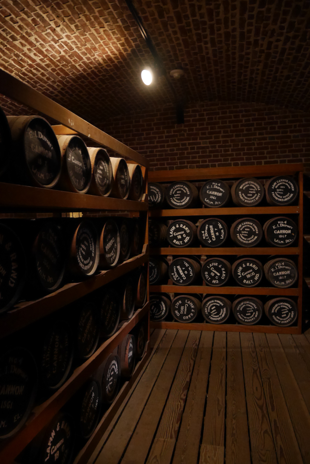
The reconstructed powder magazine of Fort Point, in the scarp side of the fort. (This display was under renovation when I shot this video, which is why it does not appear in the video. I took this picture in 2019.)
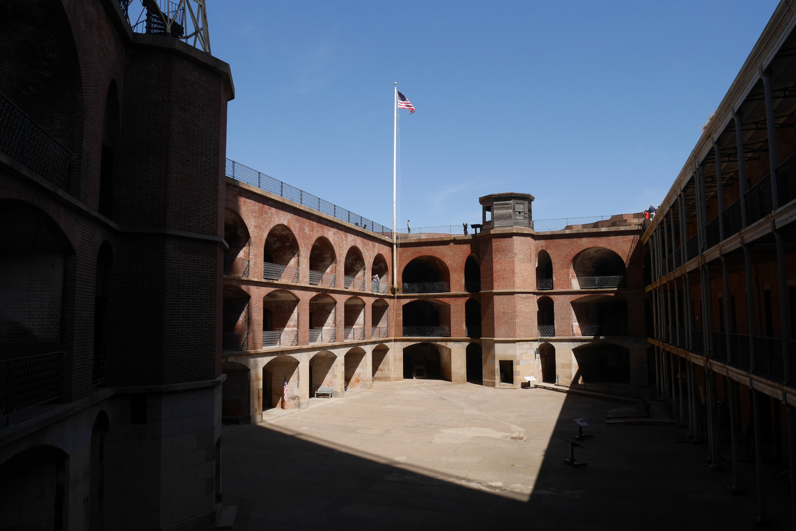
View of the parade ground inside Fort Point. The three arched tiers around the courtyard are the casemates, where the guns were mounted to protect against enemy ships.
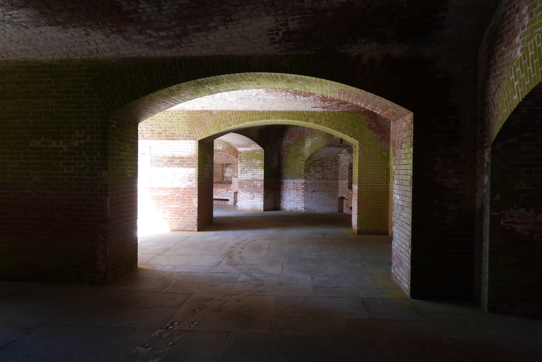
The vaults in the casemates.
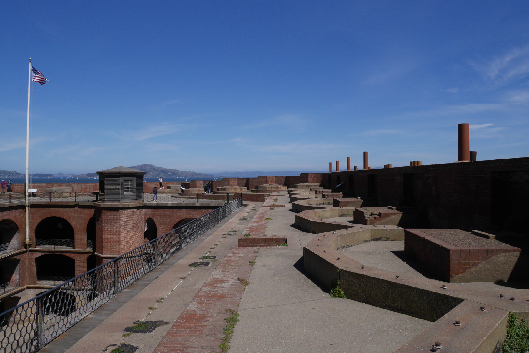
View from the top level of the fort.
Sources
- Charlesworth, Timothy J. “Defending America’s Shore: A Historical Analysis of the Development of the U.S. Army’s Fortification System, 1812-1950.” Master’s thesis, U.S. Army Command and General Staff College, 2000. https://apps.dtic.mil/sti/pdfs/ADA384106.pdf.
- Cultural Resources and Museum Management Division. Abbreviated Fort Point Historic Structure Report. San Francisco: Golden Gate National Recreation Area, 2006.
- National Park Service. Fort Point. N.p.: Government Printing Office, 2017.
- Smith, Mark A. Engineering Security: The Corps of Engineers and the Third System Defense Policy, 1815-1861. Tuscaloosa: University of Alabama Press, 2009.
- Stephenson, John. “Deterrence in Stone: Seacoast Fortresses of the 19th Century.” Periodical: Journal of America’s Military Past 20, no. 2 (summer 1993): 10-18.