
Much of the land occupied by the great metropolis of Mexico City was once underwater. Before modern times, the Valley of Mexico was flooded by Lake Texcoco and adjoining bodies of water. The Aztecs founded their capital city, Tenochtitlán, on an island in the lake in 1325. Two hundred years later, Spanish conquistadors were astonished by the scale of the city and the causeways connecting the islands of the lake to the mainland. The Spanish conquered Tenochtitlán in 1521 and built their new colonial capital, Mexico City, on its ruins. Over the following centuries, engineers built drainage works to control the floods and eventually drain the lake almost completely. (A monument to one of these engineers, Enrico Martínez, stands next to the city’s cathedral.) All that is left of Lake Texcoco now is some marshland near the international airport on the east side of the city. Some canals on the adjoining lake to the south, Xochimilco, have also survived.
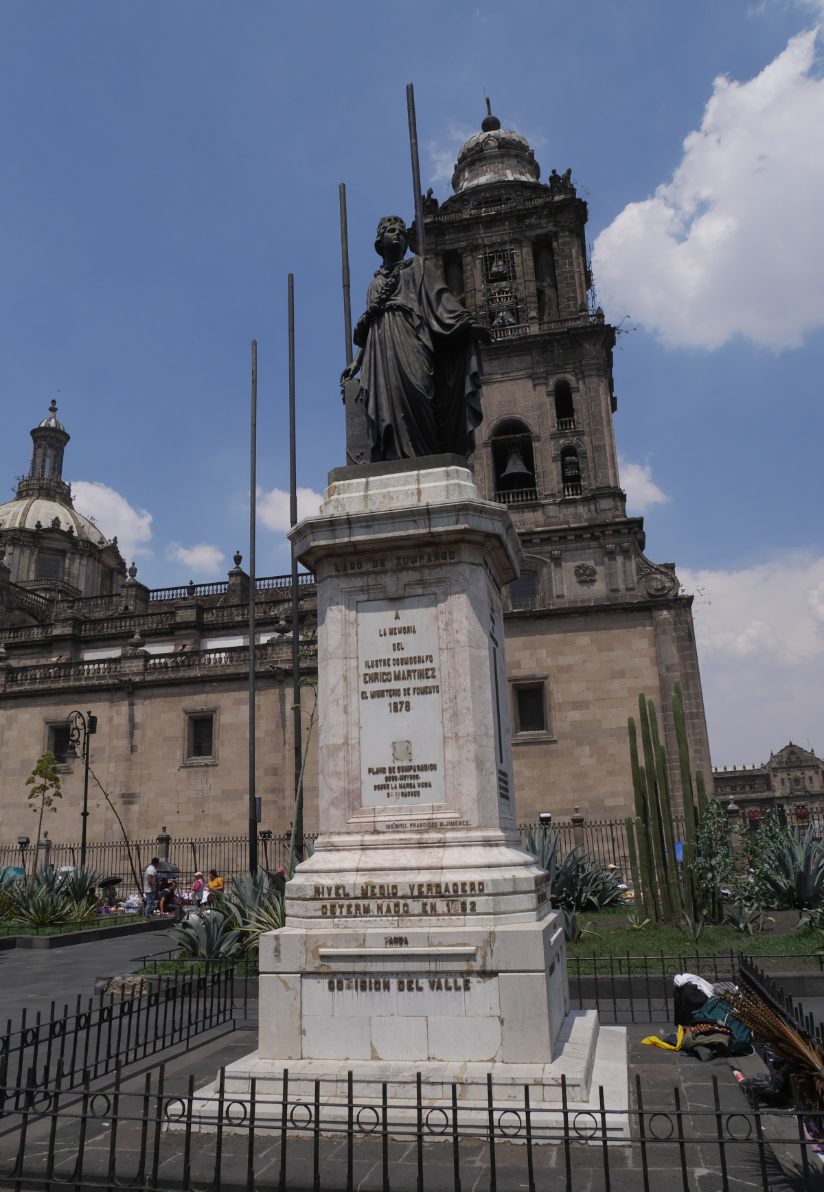
Monument to Enrico Martínez, one of the engineers who built drainage works on Lake Texcoco.
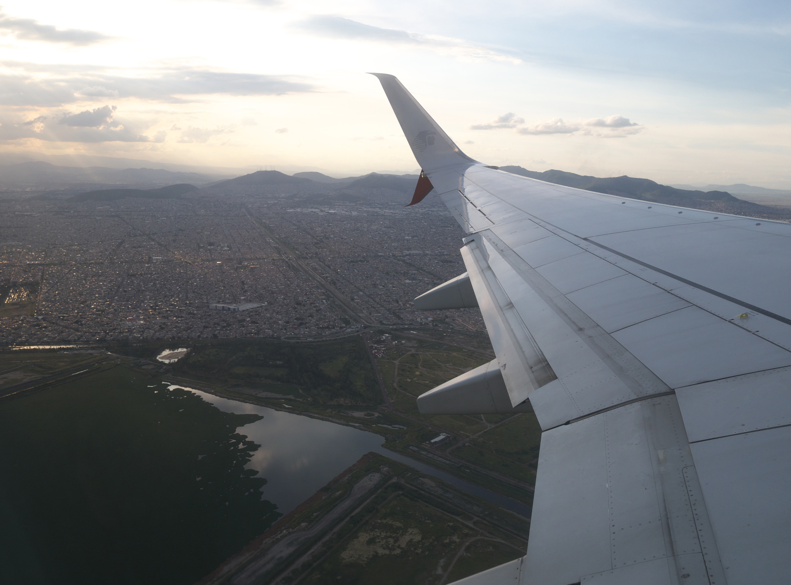
Some of the marshy remnants of Lake Texcoco, as seen from a flight out of Benito Juárez International Airport.

One of the surviving canals of Lake Xochimilco, a popular place for boat-rides in southern Mexico City.
Where exactly was Lake Texcoco? When I have visited Mexico City, I have wondered what parts of the city were above-water (islands or lakeshore), and what parts are reclaimed lakebed. I thought that someone must have made a map of the modern-day city with the outline of the erstwhile lake superimposed on it, but I was not able to find one. So I made my own.
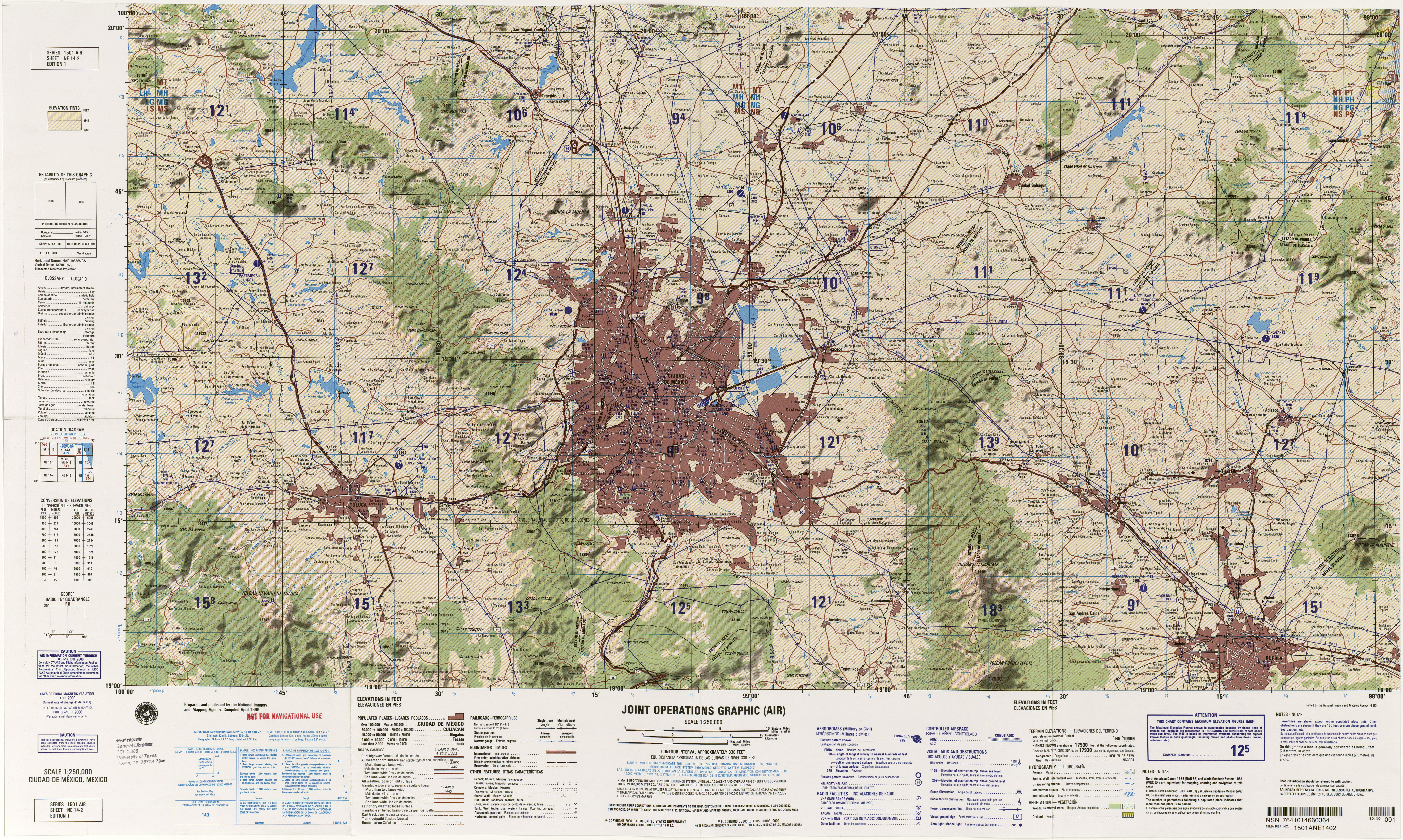
For the modern city, I used a 1:250,000 sectional chart that was jointly issued by the governments of the United States and Mexico in 2000. (It is part of the maps collection of the Perry-Castañeda Library of UT–Austin.) This map was a good find because it is big enough to cover the entire basin once flooded by the lakes, but it is detailed enough to include contour lines. For the outline of the lake, I used a map from Wikimedia Commons.
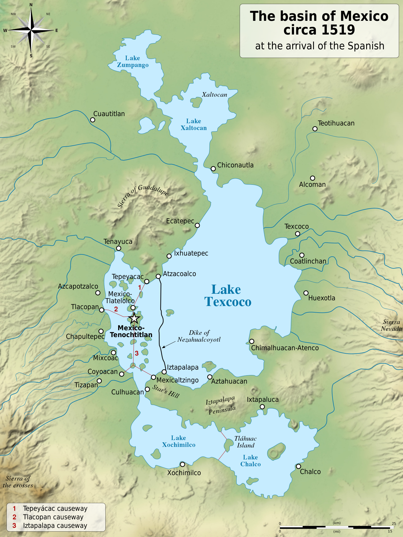
Map of the Valley of Mexico ca. 1519. (Source: Wikimedia Commons, CC-SA 4.0.)
I initially tried superimposing the lake map directly on the sectional chart, but I was never able to get the geographical points to line up. My second attempt (and this was successful) was to hand-draw the outline of the lake onto the sectional, using surviving Aztec place-names and contour-lines for reference. (I also had to use some guesswork.) Here is the result:
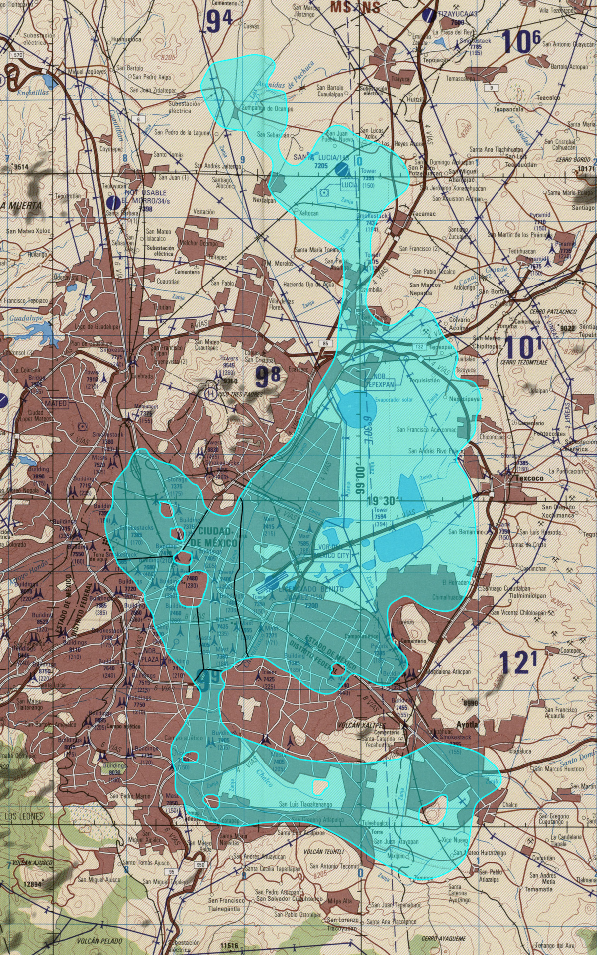
Map of Lake Texcoco and adjoining lakes superimposed over modern-day Mexico City.
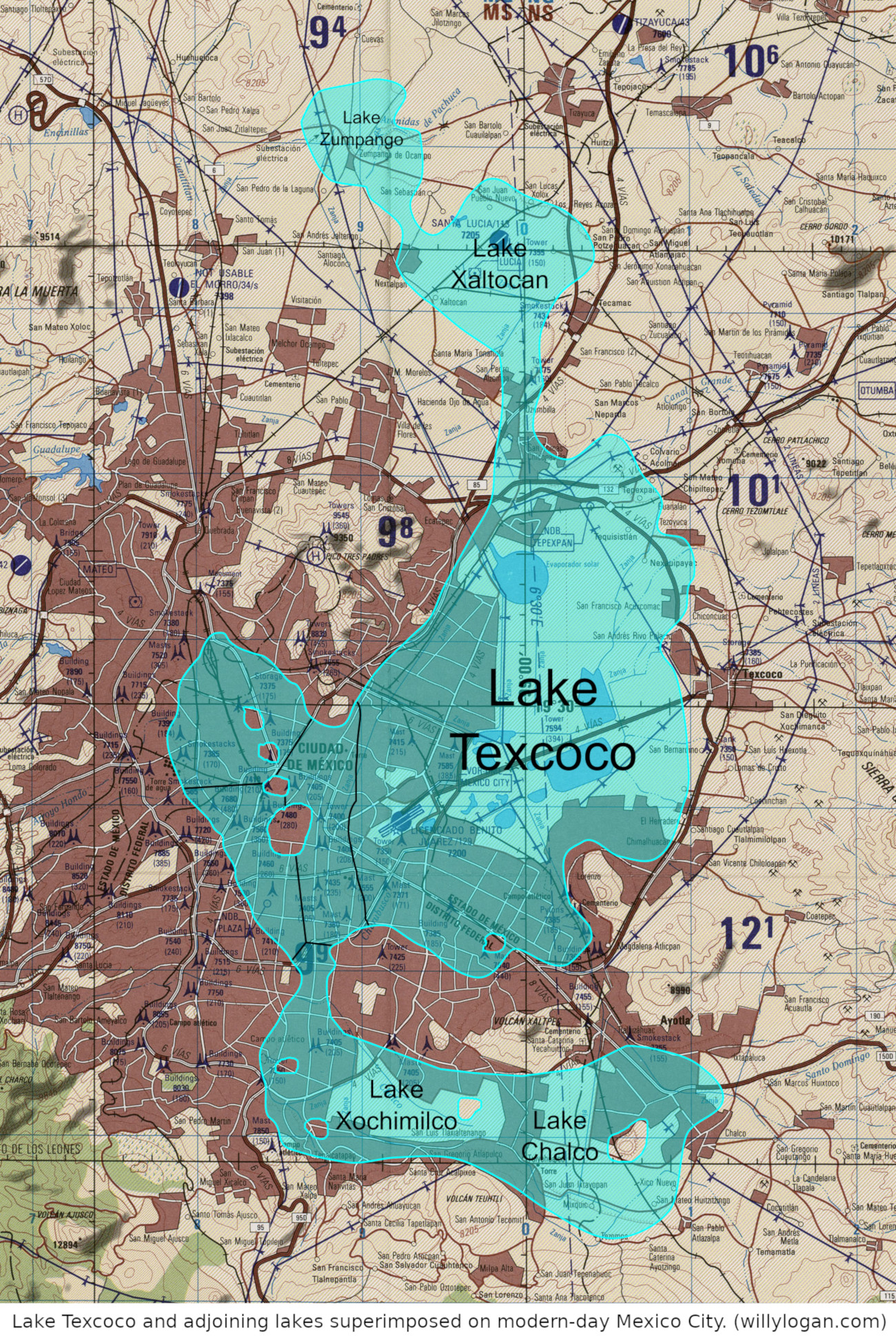
The map with the lakes labeled.
Some observations from this exercise of historical mapping:
- A considerable portion of the erstwhile lakebed, including land to the east of the international airport, is still not built-up.
- The marshes near the airport must have been the lowest part of the lakebed.
- The western edge of the modern urbanized area, including such Aztec place-names as Chapultepec, Mixcoac, and Coyoacán, was on the western shore of the lake and thus was never underwater—except during floods. (Rule of thumb: places with Aztec names were at least partly above-water.)
- But much of the city was underwater, including the most modern parts where there are high-rise buildings (Zona Rosa).
Now that I have made this map, I would like to see a detailed view of the territory around Tenochtitlán, which corresponds with the area around the Zócalo. Where exactly were the islands that the city was built on? But making such a map is a project for another time (and possibly another person as well).