WillyLogan.com

Technology, History, and Place

Tag: dams (Page 1 of 3)

Martin Dam backside

A gallery of Alabama dams

As I described in my previous post, Alabama has some old and impressive dams. Although I lived within easy driving distance of several of them in graduate school, I knew nothing about them for the first two years that I lived in Alabama. My discovery of these dams at the end of my second year of grad school was a revelation. It changed how I viewed Alabama. It also sparked an enduring interest in dams that influenced my dissertation topic and subsequent research.

After my first encounter with the dams of Alabama, I made it a point to visit as many dams as I could in my remaining two and a half years living in the state. Here is a gallery of my pictures of the dams that I saw, organized by river system.

Tallapoosa and Coosa Rivers

The Tallapoosa and Coosa are two rivers in the Piedmont of east-central Alabama. The rivers exit the Piedmont and flow into the flatlands of the Black Belt before joining together near Wetumpka and becoming the Alabama River, which drains into the Gulf of Mexico at Mobile Bay.

Alabama Power, a private electric utility, built dams on the Tallapoosa and Coosa in the early 20th century. I was able to see all of those dams, as well as some newer ones. There are also Army Corps of Engineers lock-and-dams downstream on the Alabama River, but I never got to see any of them.

Lay Dam (1914)

Starting with the Coosa River, which is the western of the two. This is Lay Dam, Alabama Power’s first dam in the Alabama Piedmont. It entered service in 1914. Originally named Lock 12 Dam, it was renamed in honor of the founder of Alabama Power in 1929.

Mitchell Dam

Mitchell Dam, downstream from Lay Dam and completed in 1923.

Jordan Dam

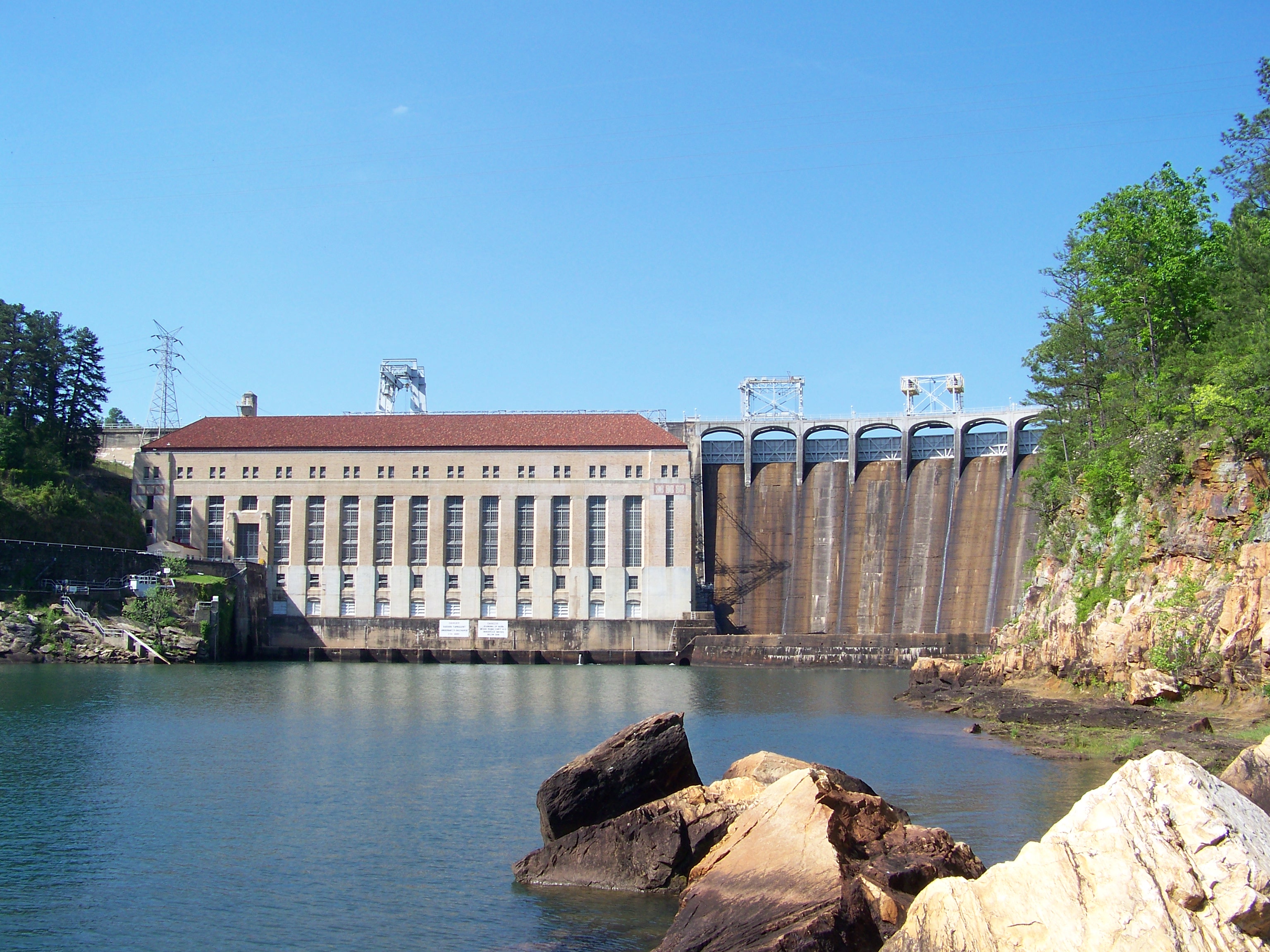
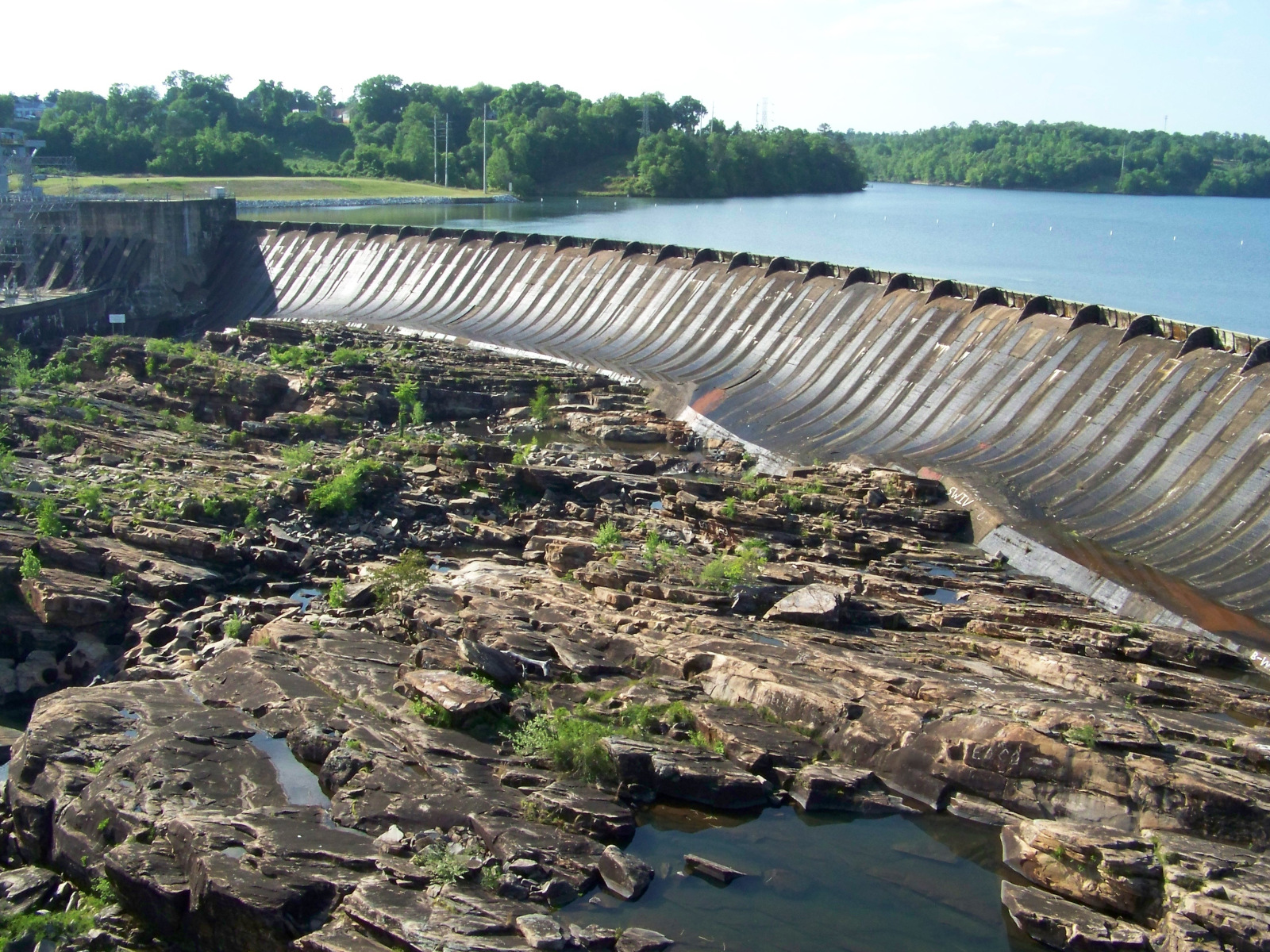
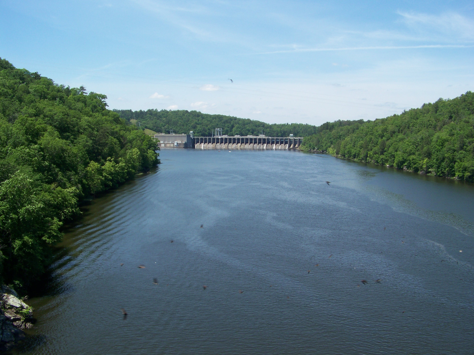
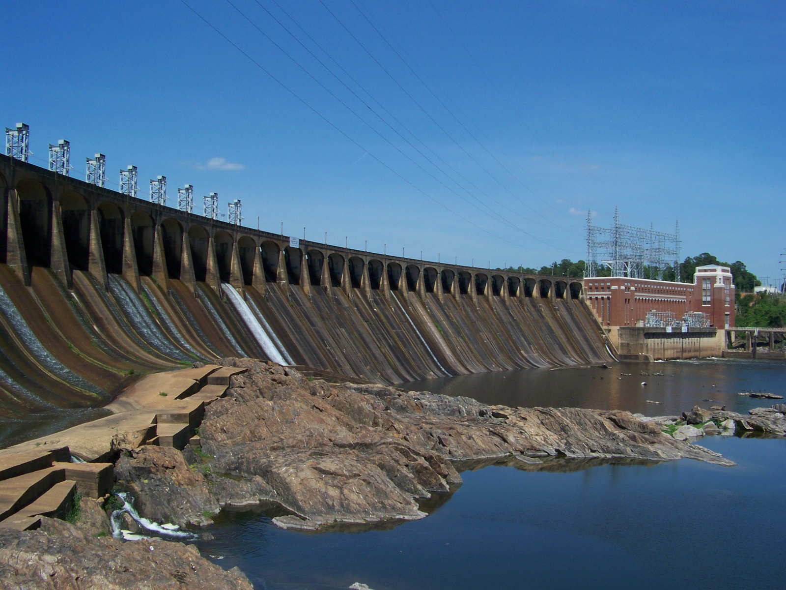
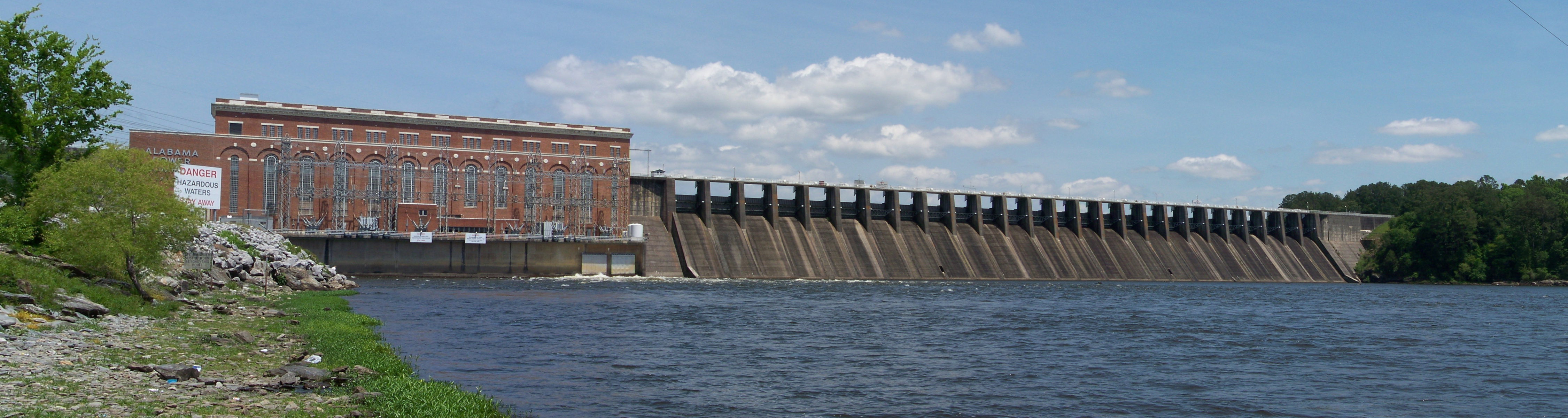
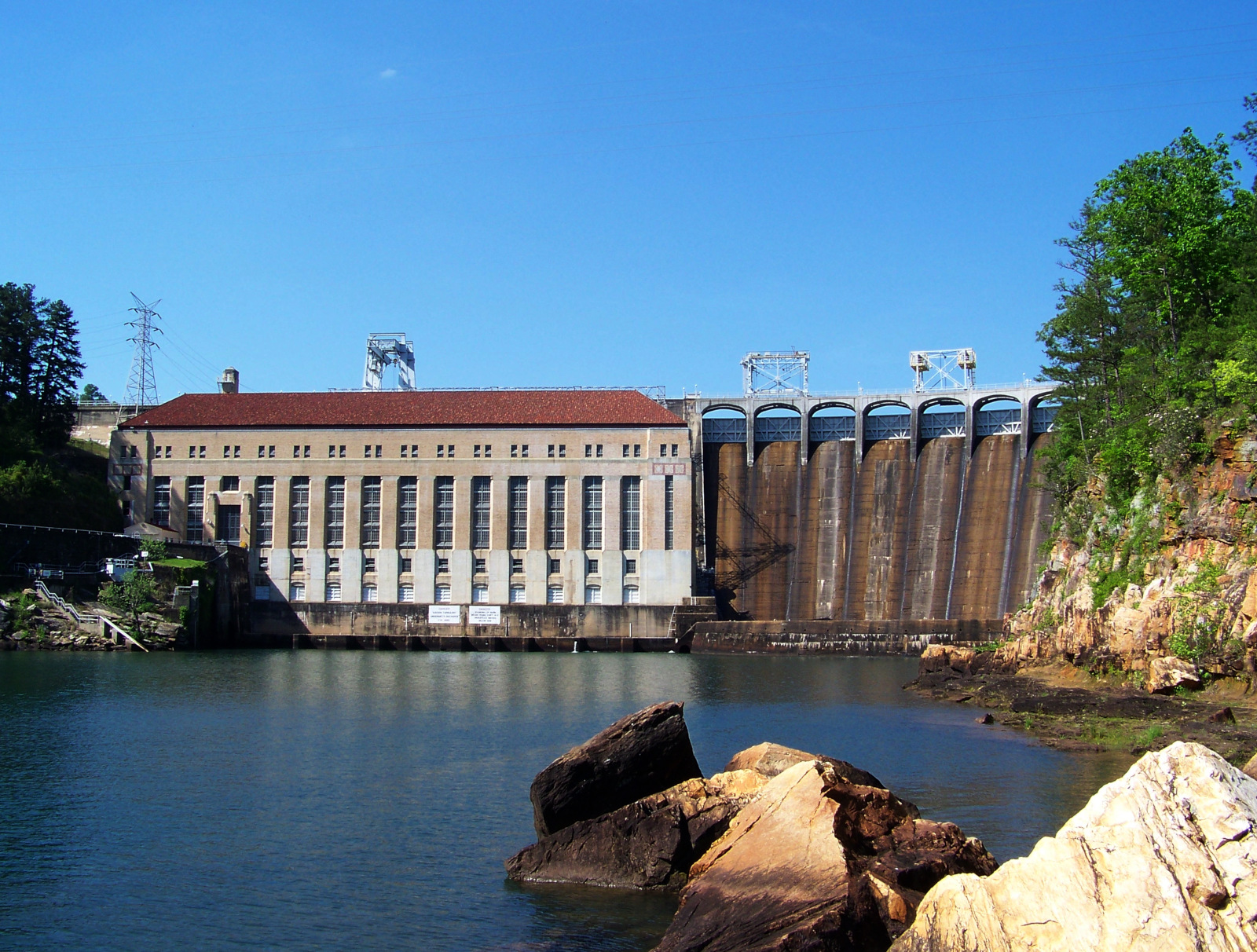
Jordan Dam (1928), the last dam on the Coosa River. It is located at the Fall Line, where the Coosa reaches the flatlands of the Black Belt. This is the most impressive of the Alabama Power dams, in my opinion.

Jordan Dam powerhouse

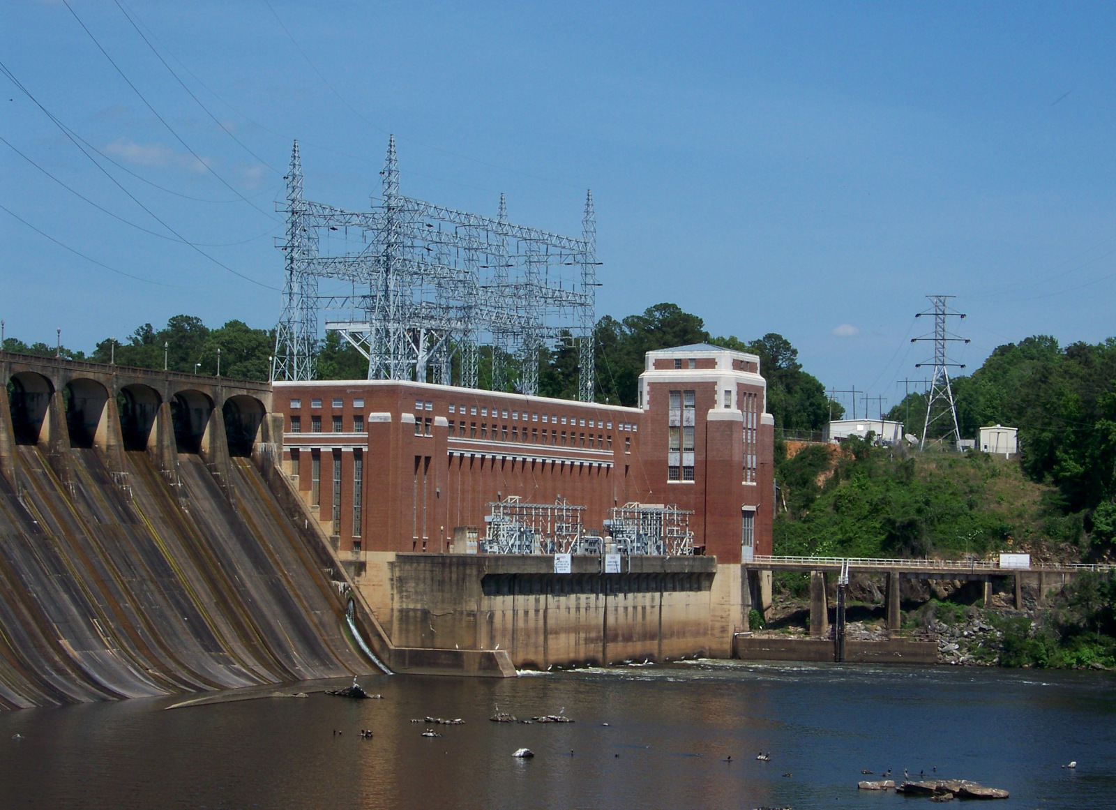
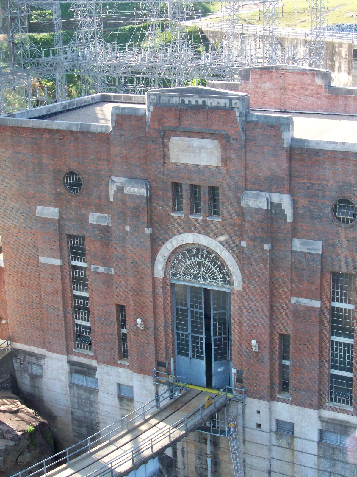
Jordan Dam powerhouse.

Jordan Dam monument

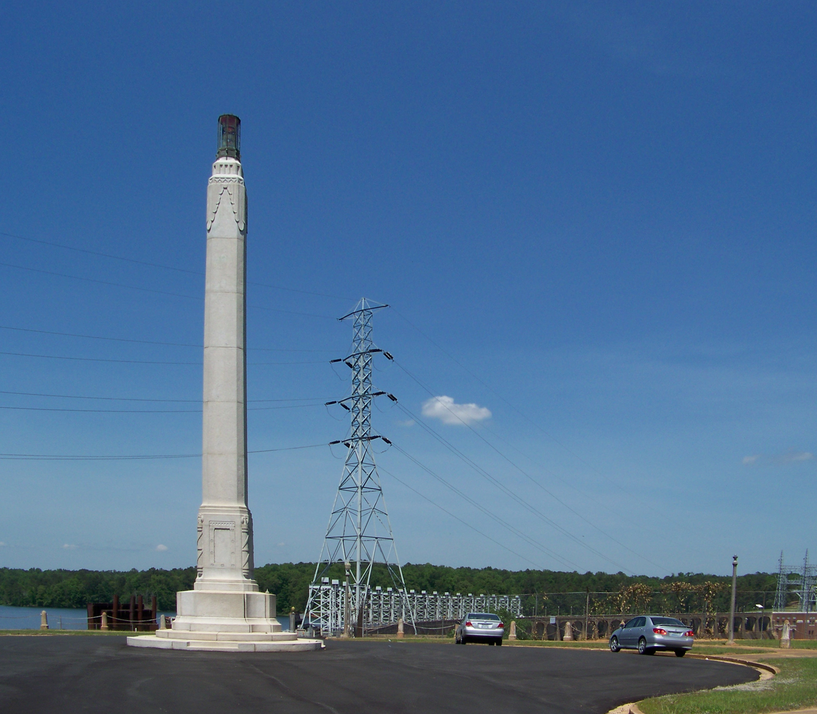
Art Deco monument at Jordan Dam.

Martin Dam (1926)

The biggest dam on the Tallapoosa is Martin Dam (1926), which impounds the attractive Lake Martin. It is tucked away in a ravine and hard to get a good picture of.

Yates Dam (1928)

Downstream from the Tallapoosa is the smallest dam on the Tallapoosa, Yates Dam. Completed in 1928, it was built on the site of Alabama’s first hydroelectric plant, which was built in 1912. This is a telephoto view from the next dam downstream, Thurlow Dam.

Yates Dam lake

The pretty lake behind Yates Dam.

Thurlow Dam at dusk

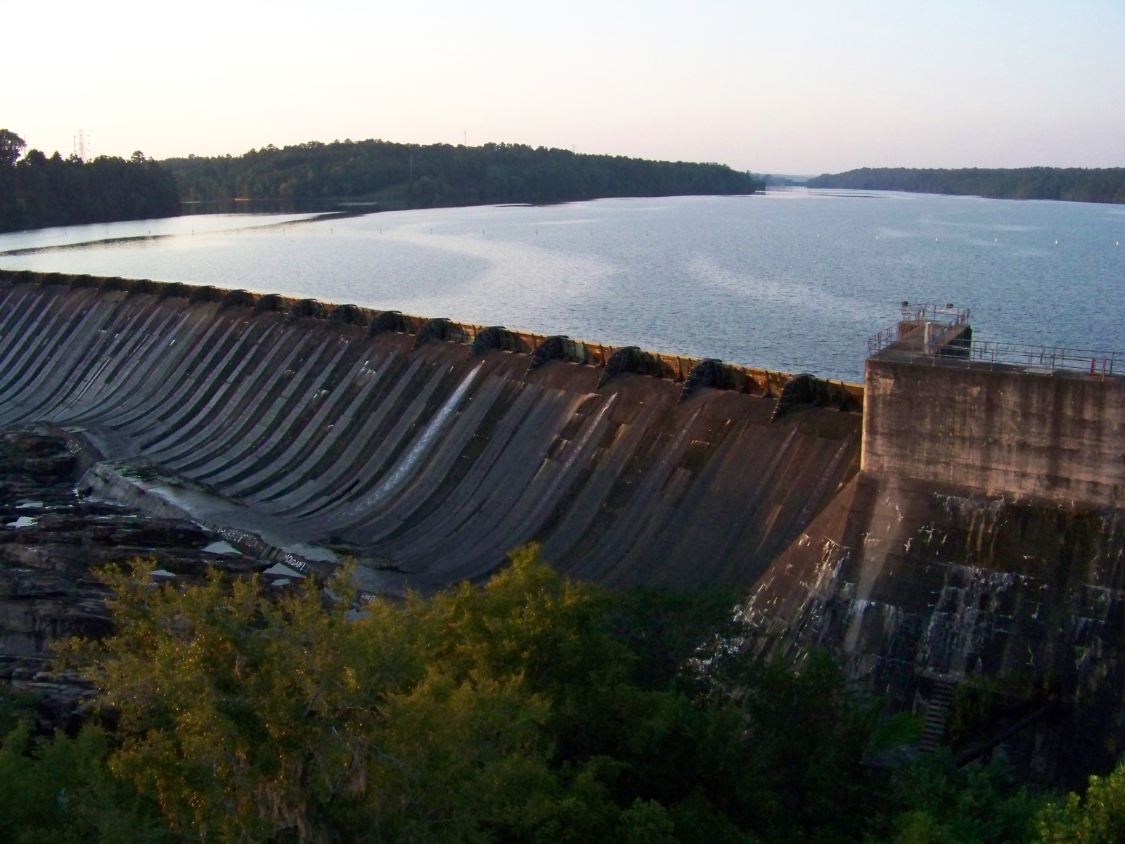
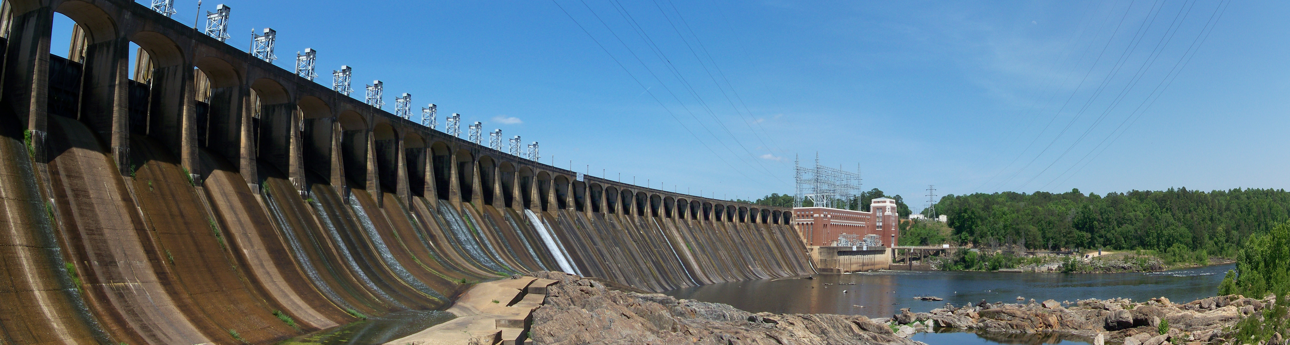
Thurlow Dam (1930), at Tallassee on the Fall Line. It is the easiest to see of any of these dams, because a bridge runs right in front of it.

Thurlow Dam panorama

Panoramic view of Thurlow Dam.

Logan Martin Dam

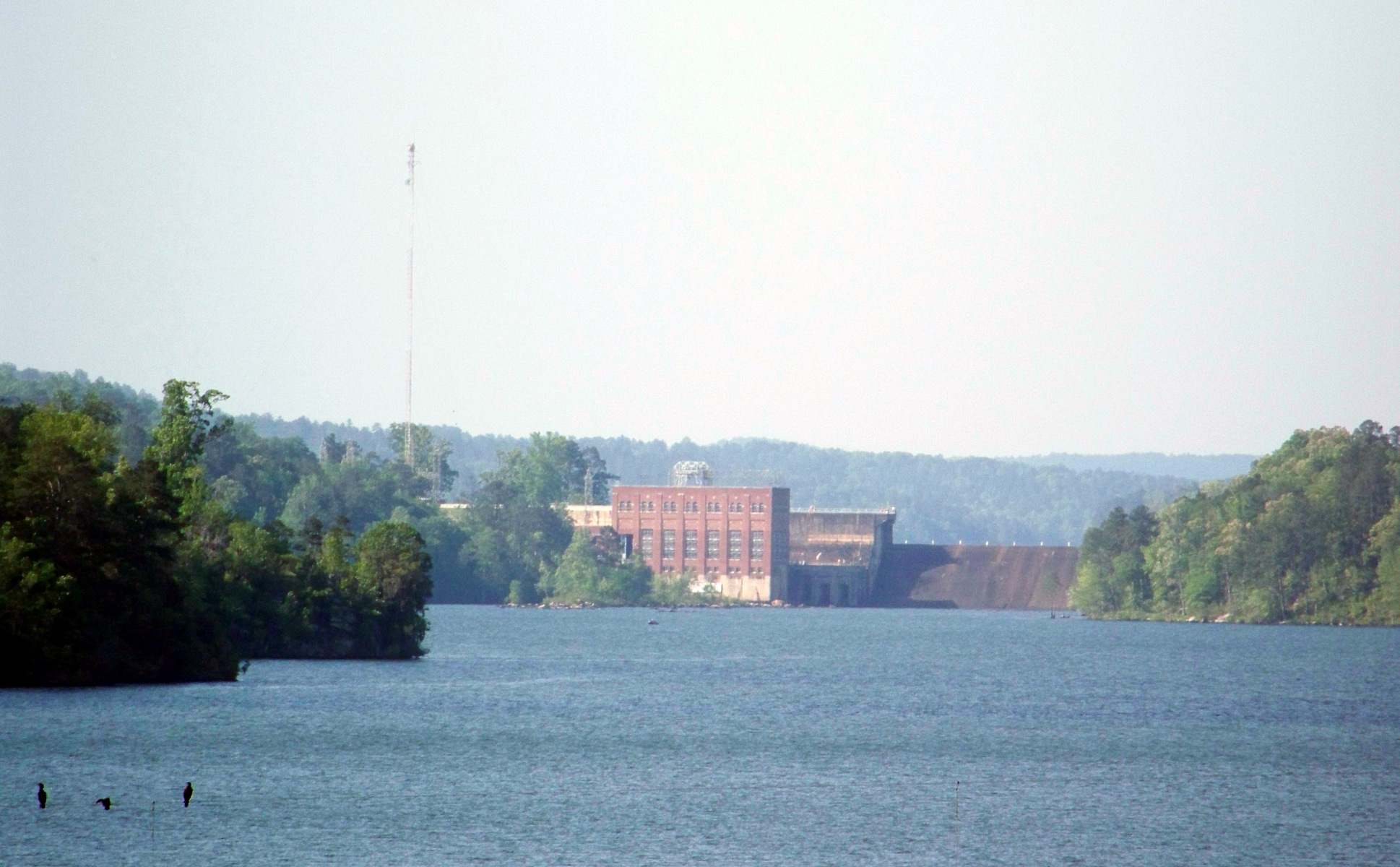
I was able to see two newer dams on the Tallapoosa–Coosa river system. This one is Logan Martin Dam, upstream of Lay Dam on the Coosa. It is named after William Logan Martin (a truly auspicious name!), an attorney-general of Alabama. A road runs across its crest.

Bouldin Dam (1967)

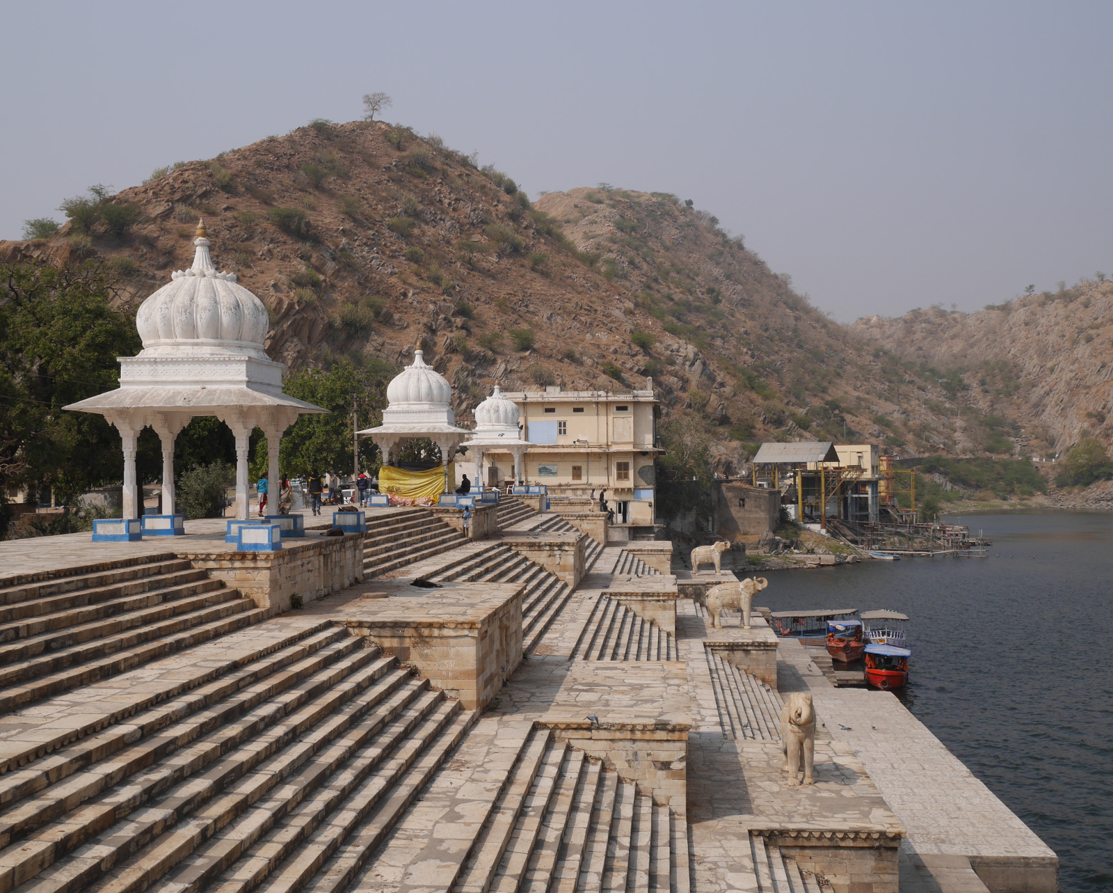
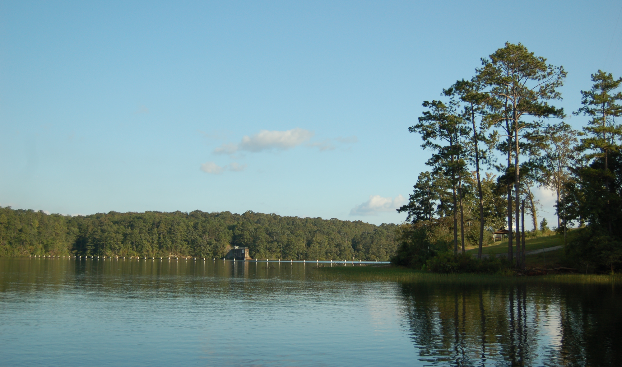
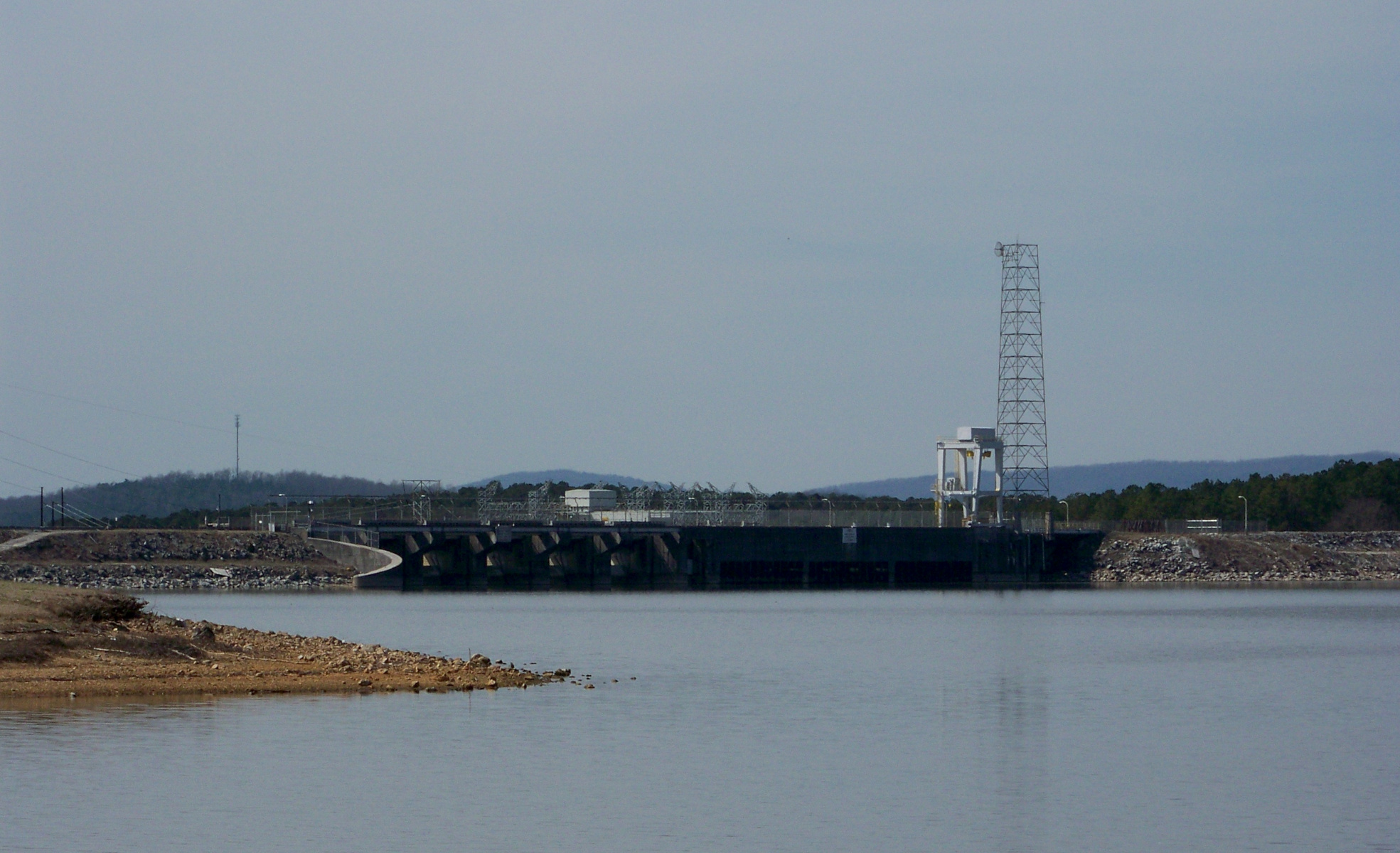
The most unusual dam on Tallapoosa–Coosa is Bouldin Dam (1967). What makes it unusual is that it is built on an artificial canal connected to the Coosa River, rather than the river itself. Although the dam itself is not especially impressive, it has the largest powerhouse of any of the dams on the Tallapoosa–Coosa (225 MW).

Black Warrior River system

On the western side of the state, Alabama Power has three dams on the Black Warrior River system: Smith Dam, Bankhead Dam, and Holt Dam. Once, on the way back from a camping trip in Bankhead National Forest, I tried visiting all three dams, but I was only able to visit Smith Dam. I made it as far as the locked gate for Bankhead Dam, and I missed the turn for Holt Dam entirely and just drove through Tuscaloosa and headed home.

Smith Dam (1961) is located on the Sipsey River, a tributary of the Black Warrior. As a postwar rockfill dam, it has a fairly cyclopean appearance.

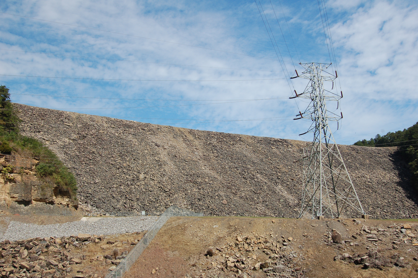
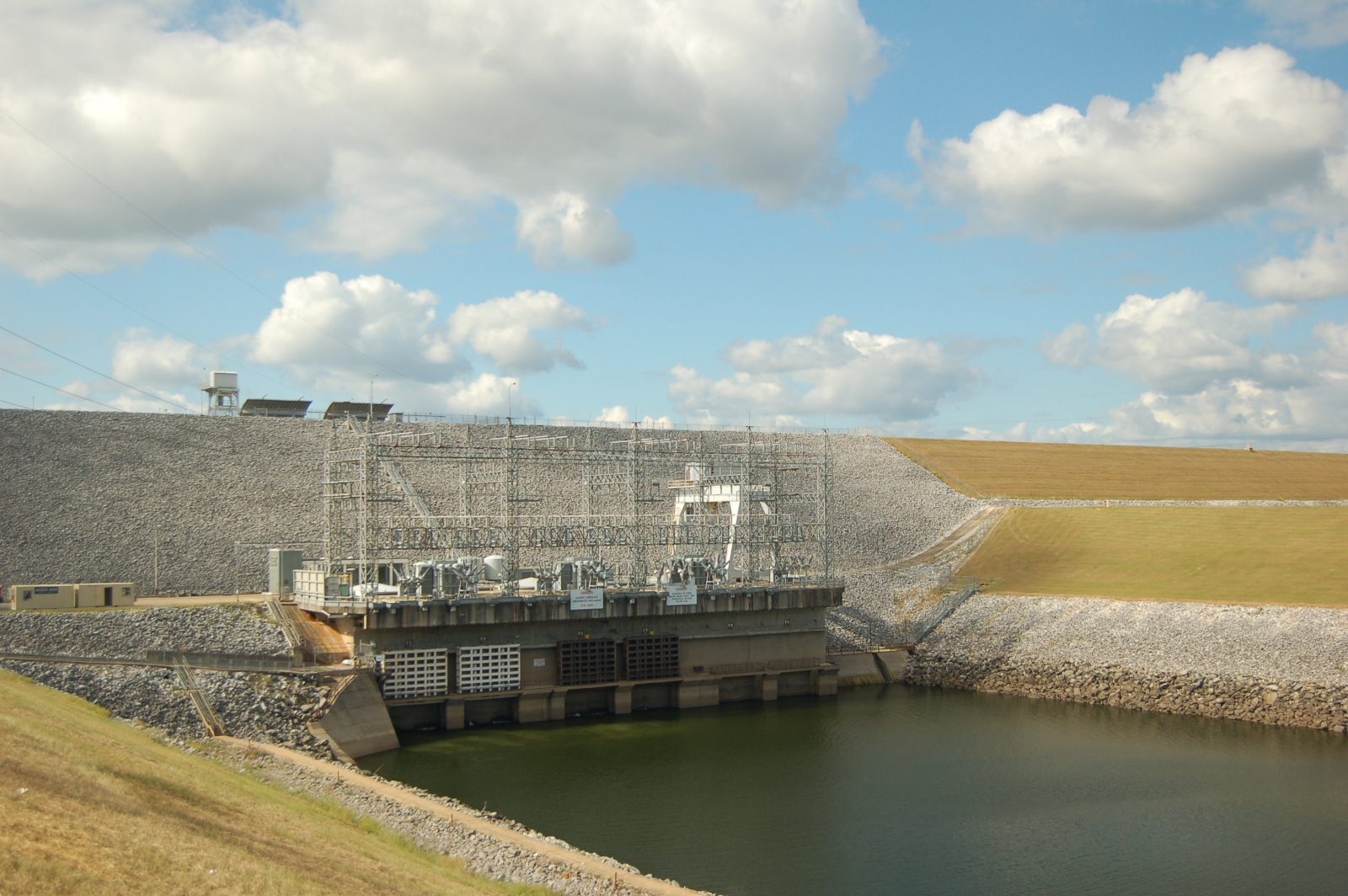
Smith Dam (1961) is located on the Sipsey River, a tributary of the Black Warrior. At 300 feet high, it is the tallest dam in Alabama. It is a postwar rockfill dam and has a fairly cyclopean appearance.

Smith Dam powerhouse

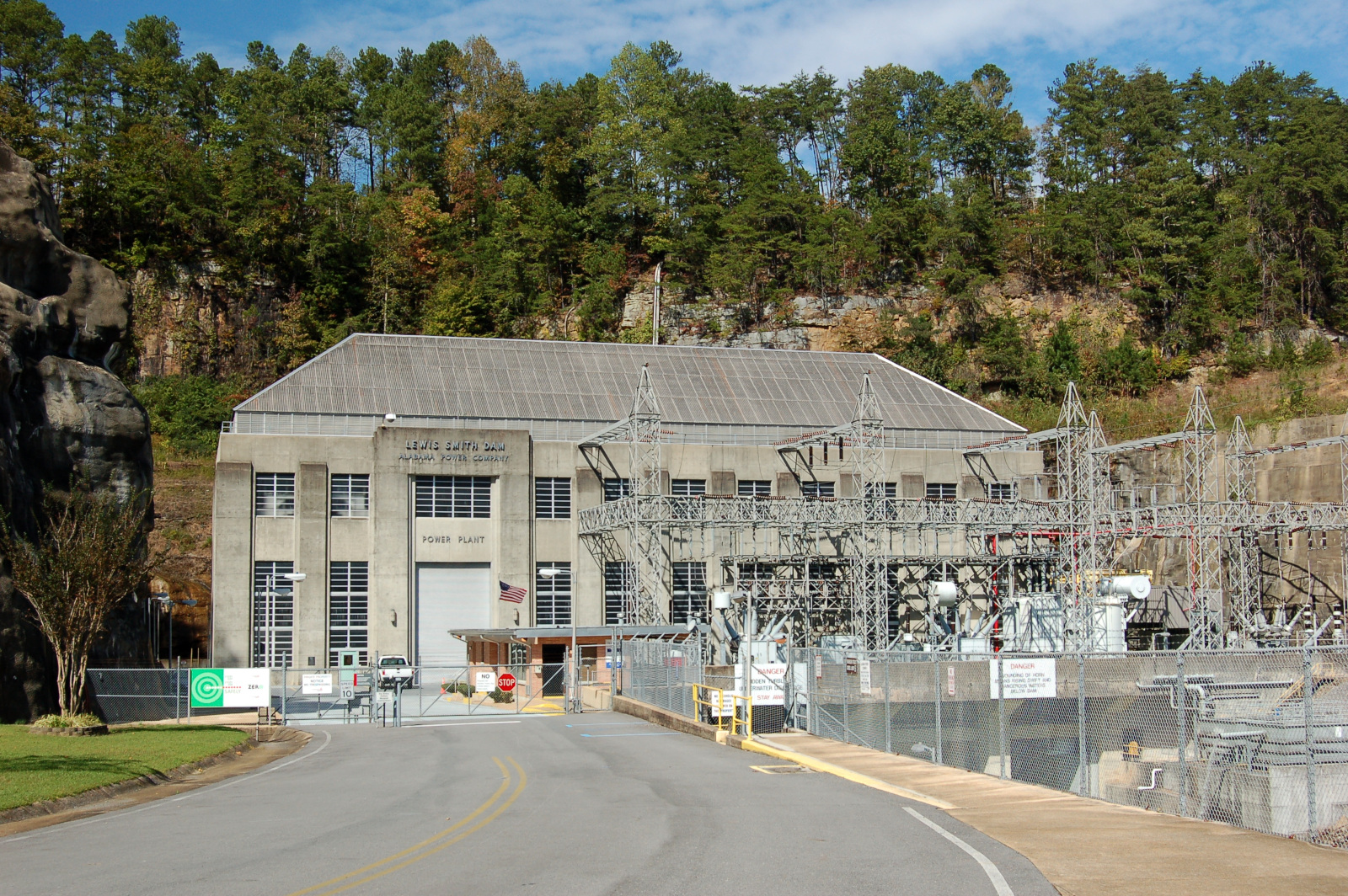
Smith Dam powerhouse.

Tennessee River

The Tennessee River makes a giant bend through northern Alabama, and it is dammed three times during its course through the state. I was able to visit two of the dams (Wheeler and Wilson), but I was never able to make it to the third (Guntersville). All three of the dams are owned and operated by the Tennessee Valley Authority, a public utility established in 1933 during the New Deal.

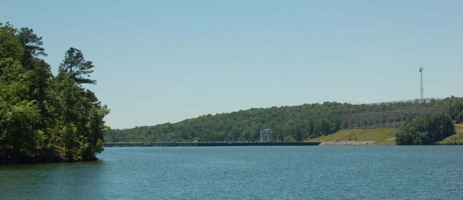
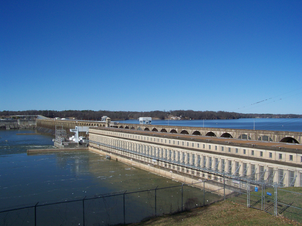
Wilson Dam, between Muscle Shoals and Florence in northwestern Alabama, is the oldest of the three TVA dams in the state. Built in World War I to power a munitions factory, it became part of the TVA when the utility was established by act of Congress. Wheeler Dam, not far upstream, was completed in 1936. Both dams are much larger than the Alabama Power dams to the south. Wheeler Dam is over a mile long and has a powerhouse with a generative capacity of 402 MW.

Wilson Dam

Wilson Dam on the Tennessee River.

Wilson Dam spillway

Detail of the Wilson Dam spillway.

Wilson Dam roadway

Driving across Wilson Dam.

Wheeler Dam pan

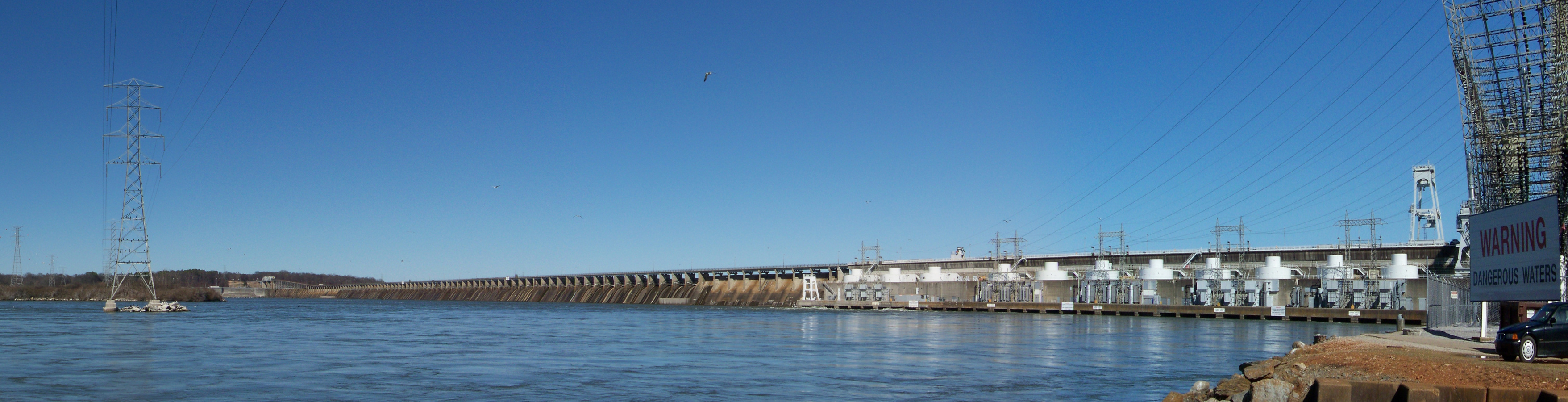
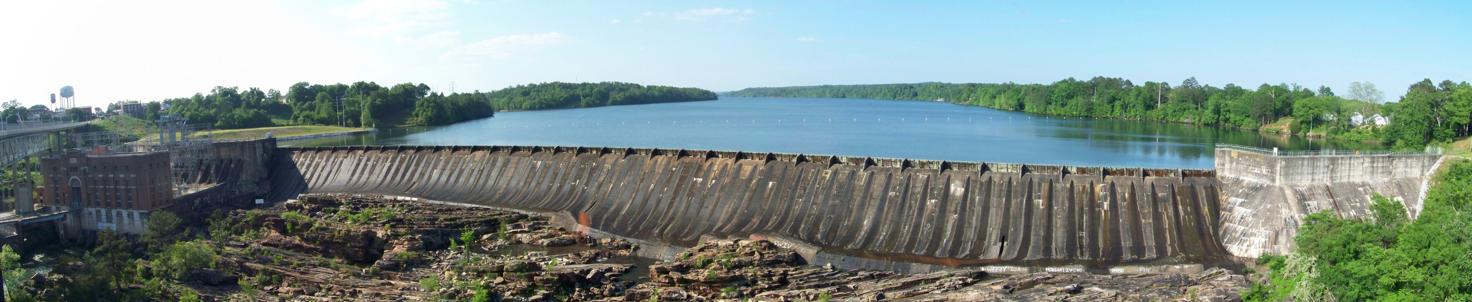
Panoramic view of the amazingly long Wheeler Dam.

Wheeler Dam spillways

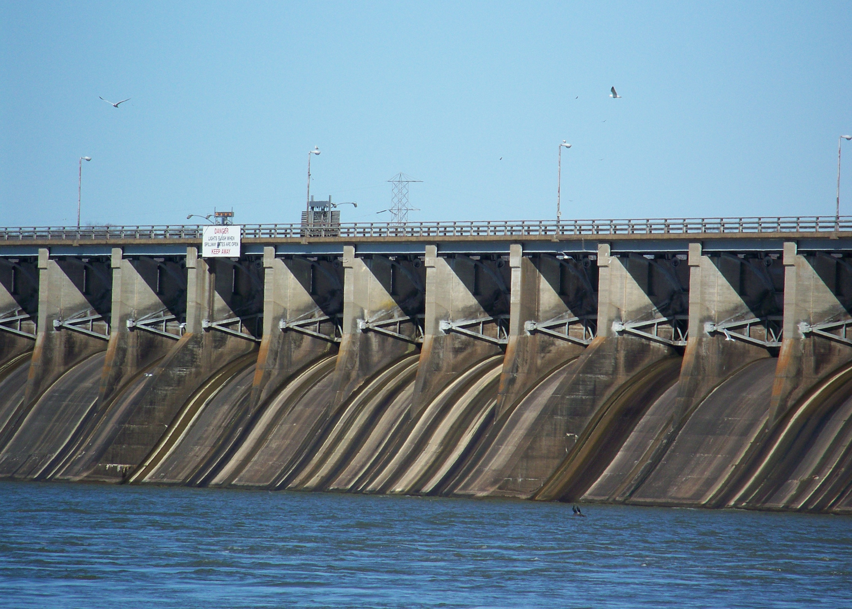
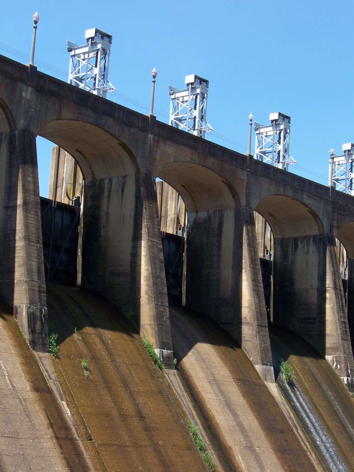
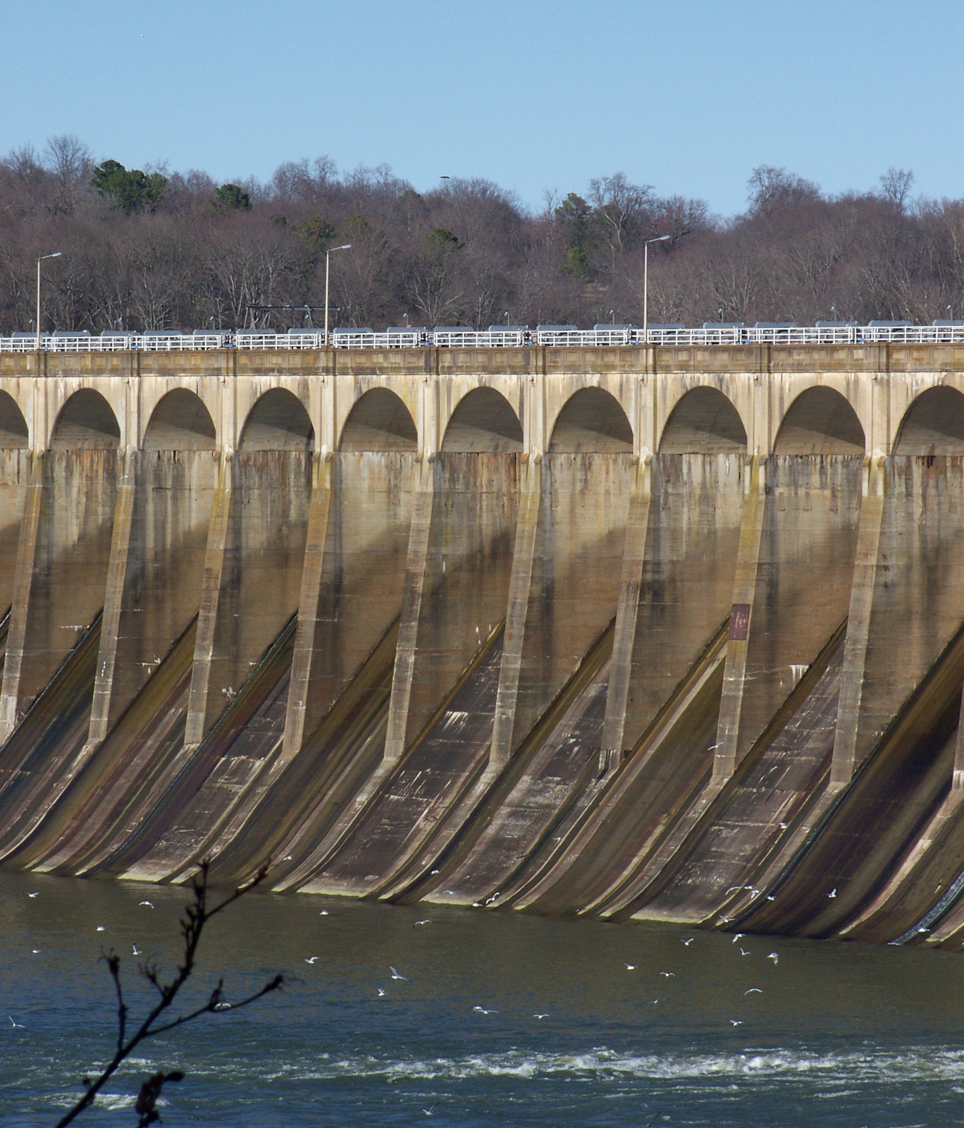
Detail of the spillways on Wheeler Dam (more modern and less elegant than the Wilson Dam spillways).

Wheeler Dam lock bridge

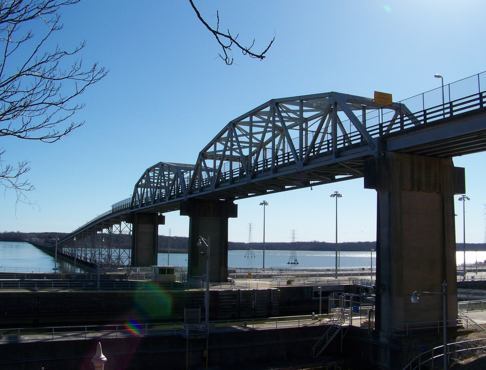
Bridge over the Wheeler Dam lock.

Wheeler Dam antique crane

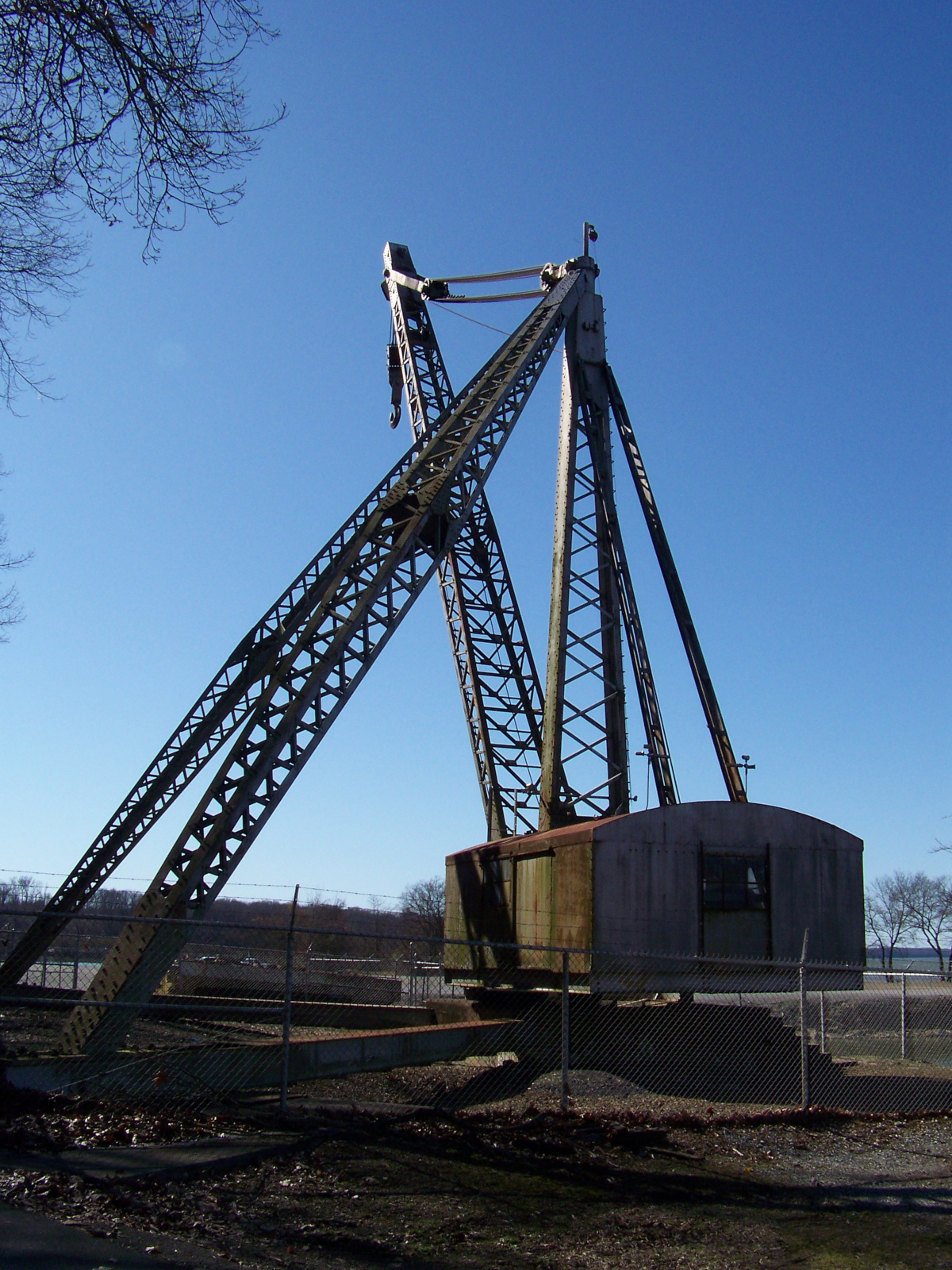
An antique crane on display on the southern side of Wheeler Dam. (It made me think of the children’s book Mike Mulligan and His Steam Shovel.)


Links

Martin Dam backside

Discovering the dams of Alabama

When I moved to Alabama for graduate school ten years ago, the American Southeast at first seemed less interesting than I had hoped it would be. I’d had ideas that the Southeast would have a strong sense of history, because this was where the Civil War and Civil Rights Movement had taken place. But I found that most of the towns in east-central Alabama did not seem particularly old or historic. The town of Auburn, where I lived, consisted mostly of postwar construction, with only a few nineteenth-century buildings. It was not until the end of my second year of grad school that I found something in Alabama that really inspired my sense of history in a uniquely historian-of-technology way: dams.

I was no stranger to dams. As the son of a power engineer, I had visited my share of dams on family vacations. I had also gone to college in Washington State, and I would see dams along the Columbia River whenever I drove to Portland. But it wasn’t until the end of my second year in Alabama that it occurred to me that there might be some dams near me. I was vaguely aware that there must be a dam at the end of Lake Martin, which I would cross over on the way to Birmingham. But I had no idea what it looked like, who built it, or when.

Lake Martin view

Lake Martin on an October morning.

In the spring of my second year of grad school, I had been reading about dams built in India during Nehru’s time as I hunted for a dissertation topic. It occurred to me one fateful day that there were dams on the Tallapoosa River nearby that I had never seen, and they might make for an interesting Saturday afternoon excursion. Looking at a map, I found that I could see three of the Tallapoosa’s dams in a single trip, including the dam that impounded Lake Martin.

The first dam on my tour was Martin Dam, which I reached by taking AL-50 off of US-280 at Camp Hill. The road swings around the southeastern side of Lake Martin and passes over a bridge right in front of Martin Dam. There was no overlook for the dam, but I did find a place to pull off to the side of the road and park. The dam itself was tucked back in a canyon; I found a vantage point of it by following an abandoned roadbed for an old bridge across the river. The dam was big and impressive, if not exactly colossal.

Martin Dam

Martin Dam on the Tallapoosa River, built 1923-1926.

I continued south along the Tallapoosa. The next dam, Yates, did not appear to be accessible. (I later got a view of it from downstream.) But the last dam, Thurlow, was right in the middle of the town of Tallassee. A bridge ran right in front of it, and I could see the whole thing from a sidewalk on the bridge.

Thurlow Dam face

The face of Thurlow Dam on the Tallapoosa River, completed in 1930.

Thurlow Dam powerhouse

Thurlow Dam powerhouse.

From Tallassee, I took AL-14 straight back to Auburn. I eagerly sorted my pictures from the day. The next day, I checked out a book from the university library about the construction of the dams I had just seen: Putting “Loafing Streams” to Work: The Building of Lay, Mitchell, Martin, and Jordan Dams, 1910-1929, by Harvey H. Jackson. In the book, I read about how Alabama Power had transformed the landscape of the Alabama piedmont by building dams on the Tallapoosa and Coosa Rivers in the early twentieth century.

Seeing the dams and learning about their history opened up previously unexplored terrain in my mental map of Alabama history. It turned out that there were other interesting things that had happened in the state besides Civil War and Civil Rights. Those dams had been there the whole time I had been here, and much longer. They told stories of ambition, development, hard work, and not a little modernist hubris. Until embarking on my study of Alabama’s dams, I had no idea those stories were there to be told. Now that I’d started to listen to the stories, Alabama began to seem a good deal more interesting than it had before.

Lay Dam

Lay Dam, completed in 1914, was Alabama Power’s first dam built on the Coosa River.

Mitchell Dam

Distant view of Mitchell Dam on the Coosa River, completed in 1923.

Jordan Dam

Jordan Dam, completed in 1928, is the lowest dam on the Coosa River. The rocks in the foreground were part of Devil’s Staircase, a series of rapids that was destroyed by the construction of the dam.

Jordan Dam spillways

Closeup of the spillways of Jordan Dam.

jaisamand-lake-pan

Jaisamand, Mewar’s superlative lake

View of the ornamented backside of Jaisamand Dam.

View of the ornamented backside of Jaisamand Dam.

In southern Rajasthan, thirty miles south of the city of Udaipur, twenty square miles of the Aravalli Mountains have been flooded by the remarkable Jaisamand Lake, formed by the 1500-ft Jaisamand Dam. Tourist guidebooks frequently erroneously refer to Jaisamand as the second-largest artificial lake in Asia. This is far from the truth; in India alone, a half-dozen artificial lakes are much larger than Jaisamand. What is remarkable about Jaisamand is the combination of its size and its age. The lake was built in 1685 on behalf of Maharana Jai Singh of Mewar. Jaisamand holds the undisputed distinction of being the largest extant pre-modern artificial lake in India.

Of the numerous Rajput kingdoms in medieval western India, Mewar was the last to submit to the Mughal Empire. In 1568, Mewar lost its capital Chittaurgarh to the army of Akbar after a long and bloody siege, but a royal remnant escaped to found a new capital at Udaipur. The Mughals tried to defeat Mewar again at the epic Battle of Haldighati in 1576, but Maharana Pratap Singh escaped with his life and his kingdom. (Alas, Pratap’s horse Chetak succumbed to his injuries during the battle, but he has since become a local hero in his own right.) Finally, in 1615, after a series of battles, Maharana Amar Singh was forced to accede to the Mughal Empire. This was more than fifty years after Amber became the first Rajput state to join the empire.

After getting dragged into the Mughal Empire, Mewar could redirect some of its resources from militarization to infrastructural development. Jaisamand Lake was one of the public works projects undertaken in the post-accession period. The lake stored water from the Gomti River, for use in irrigation. It also provided a setting for palaces and royal hunting reserves.

Jaisamand Lake has changed a little since the late seventeenth century. The original dam was refurbished around 1960. During the refurbishment, the historic front face of the dam was covered by a characterless concrete facade. The crest and backside of the dam, though, retain their historical appearance. A series of white marble steps lead down to the water. There are six stone chhatris (domed pavilions), six carved marble elephants, and a temple, Shri Narbdeshwar Mahadev Jaisamand. Despite some graffiti on the elephants, and the usual litter, Jaisamand Dam remains a place of historical importance and real beauty.

The steps on the backside of Jaisamand Dam.

The steps on the backside of Jaisamand Dam.

One of the chhatris on Jaisamand Dam. The white mark underneath the chhatri indicates the level reached by a flood in 1973.

One of the chhatris on Jaisamand Dam. The white mark underneath the chhatri indicates the level reached by a flood in 1973.

Pigeons fly over Shri Narbdeshwar Mahadev Jaisamand Temple, located front and center on Jaisamand Dam.

Pigeons fly over Shri Narbdeshwar Mahadev Jaisamand Temple, located front and center on Jaisamand Dam.

The characterless concrete face of the refurbished Jaisamand Dam.

The characterless concrete face of the refurbished Jaisamand Dam.

Jaisamand is accessible from Udaipur by Banswara-bound bus from the main government bus terminal near Udaipol. The dam and the lake are just up the hill from Jaisamand town, where the bus stops. Boat rides are available from the dam, at Rs 600 per boat for a half-hour or Rs 1200 for the full hour. On a hill just above the dam, a ruined palace stands on forest department land. Visitors can get permission to climb up to the palace from the forest department office, with payment of a fee. I thought the rate for foreigners of Rs 300 was ridiculously steep – even without the additional Rs 900 camera fee – so I opted out of that experience.

For further coverage of India’s pre-modern artificial lakes, please see my posts “Goodly Lakes” and “Another Goodly Lake.

Page 1 of 3

Powered by WordPress & Theme by Anders Norén